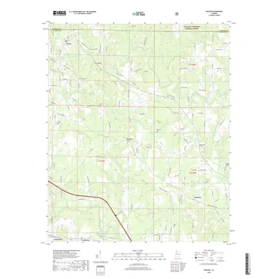
2018 Map of Nauvoo
USGS Topo · Published 2018About this map
Nauvoo and its surrounding hill country in the northern reaches of the Alabama coalfields are the focus of this detailed terrain study. The northern edge of the landscape is defined by the boundary of the William B. Bankhead National Forest, where the terrain begins to drop toward the drainage basins of Blackwater Creek and Indian Creek. Settlement patterns here are dictated by the winding creek valleys and ridgelines, with small communities like Prospect and Saragossa serving as local anchors. Several family and community burial sites, including Keeton Cemetery, Ferguson Cemetery, and King Cemetery, are documented throughout the township blocks. In the southwest corner, the proximity to the rail and mining corridor is evident as the map reaches toward Carbon Hill and Pocahontas, highlighting a landscape shaped by both timber and coal interests.
Find a feature on this map
135 named features on this map. Tap any name to fly to it.
Don’t see what you’re looking for? This feature index may not catch every label — zoom into the map to look around manually.
Map Details
Editions of this 2018 Nauvoo Map
This is the sole edition of this map. No revisions or reprints were ever made.
Other maps of this area

1893 · Jasper
USGS Topo · 1:125,000

1949 · Townley
USGS Topo · 1:24,000

1949 · Jasper
USGS Topo · 1:24,000

1949 · Manchester
USGS Topo · 1:24,000

1949 · Nauvoo
USGS Topo · 1:24,000

1950 · Nauvoo
USGS Topo · 1:24,000

1950 · Manchester
USGS Topo · 1:24,000

1951 · Jasper
USGS Topo · 1:24,000

1951 · Townley
USGS Topo · 1:24,000

1953 · Birmingham
USGS Topo · 1:250,000