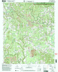
2000 Map of Nauvoo
USGS Topo · Published 2003About this map
Nauvoo and Saragossa serve as the primary hubs in this corner of the Alabama coalfields, where the landscape is defined by the tension between industrial extraction and protected wilderness. The northern reach of the map is dominated by the William B Bankhead National Forest, while the surrounding terrain is heavily marked by numerous Strip Mines. This pattern of land use reveals the region's economic reliance on coal during the late 20th century.
Find a feature on this map
40 named features on this map. Tap any name to fly to it.
Don’t see what you’re looking for? This feature index may not catch every label — zoom into the map to look around manually.
Map Details
Editions of this 2000 Nauvoo Map
This is the sole edition of this map. No revisions or reprints were ever made.
Other maps of this area

1893 · Jasper
USGS Topo · 1:125,000

1949 · Townley
USGS Topo · 1:24,000

1949 · Jasper
USGS Topo · 1:24,000

1949 · Manchester
USGS Topo · 1:24,000

1949 · Nauvoo
USGS Topo · 1:24,000

1950 · Nauvoo
USGS Topo · 1:24,000

1950 · Manchester
USGS Topo · 1:24,000

1951 · Jasper
USGS Topo · 1:24,000

1951 · Townley
USGS Topo · 1:24,000

1953 · Birmingham
USGS Topo · 1:250,000