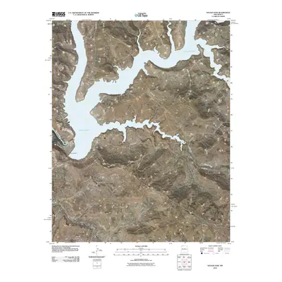
2010 Map of Navajo Dam
USGS Topo · Published 2010About this map
Navajo Reservoir dominates the high desert landscape of Rio Arriba County, where its vast waters are held back by the Navajo Dam. Just below the spillway, the San Juan River flows southwestward past the small settlement of Navajo City. The map reveals a transition from the deep blue of the impounded waters to the arid, complex topography of the south, characterized by prominent landmarks like El Gobernador Knob and the high plateaus of Frances Mesa.
Find a feature on this map
13 named features on this map. Tap any name to fly to it.
Don’t see what you’re looking for? This feature index may not catch every label — zoom into the map to look around manually.
Map Details
Editions of this 2010 Navajo Dam Map
This is the sole edition of this map. No revisions or reprints were ever made.
Other maps of this area

1889 · Largo
USGS Topo · 1:250,000

1895 · Largo
USGS Topo · 1:250,000

1954 · Pine River
USGS Topo · 1:24,000
1954 · Burnt Mesa
USGS Topo · 1:24,000

1954 · Rosa
USGS Topo · 1:24,000

1954 · Gomez Ranch
USGS Topo · 1:24,000

1954 · Aztec
USGS Topo · 1:250,000

1958 · Aztec
USGS Topo · 1:250,000

1959 · Gould Pass
USGS Topo · 1:62,500

1959 · Navajo Dam
USGS Topo · 1:62,500