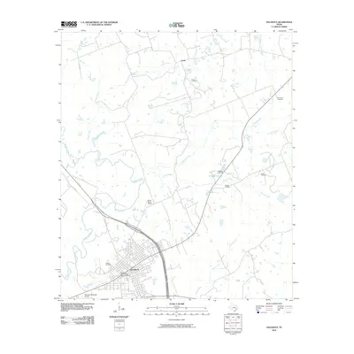
2010 Map of Navasota
USGS Topo · Published 2010About this map
The Navasota River meanders through this landscape, defining the western edge of a region marked by rural settlements and a dense grid of residential streets. Central to the area is the Navasota Commercial Historic District, indicating a well-preserved core of local commerce and architecture. This 2010 survey shows the town’s infrastructure integrated with the surrounding natural waterways, including Holland Creek and Spring Creek, which feed into the primary river system.
Find a feature on this map
21 named features on this map. Tap any name to fly to it.
Don’t see what you’re looking for? This feature index may not catch every label — zoom into the map to look around manually.
Map Details
Editions of this 2010 Navasota Map
This is the sole edition of this map. No revisions or reprints were ever made.
Other maps of this area

1913 · Millican
USGS Topo · 1:31,680

1914 · Navasota
USGS Topo · 1:62,500

1954 · Beaumont
USGS Topo · 1:250,000

1954 · Austin
USGS Topo · 1:250,000

1956 · Carlos
USGS Topo · 1:62,500

1957 · Beaumont
USGS Topo · 1:250,000

1958 · Washington
USGS Topo · 1:24,000

1958 · Navasota
USGS Topo · 1:24,000

1958 · Courtney
USGS Topo · 1:24,000

1959 · Millican
USGS Topo · 1:24,000