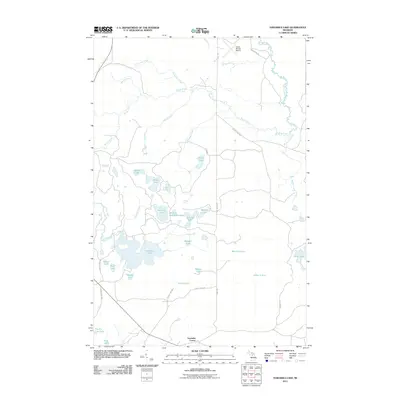
2011 Map of Nawakwa Lake
USGS Topo · Published 2011About this map
Nawakwa Lake and a dense network of smaller glacial basins define this corner of the Upper Peninsula in the early 21st century. The landscape is characterized by its complex hydrography, where the Sucker River and its various tributaries, such as Haverstock Creek and Blood Creek, wind through the timberlands north of the Seney stretch. Unlike the more developed coastal areas, this inland region remains defined by its water bodies and remote road network, including Seney Rd and County Hwy 765.
Find a feature on this map
38 named features on this map. Tap any name to fly to it.
Don’t see what you’re looking for? This feature index may not catch every label — zoom into the map to look around manually.
Map Details
Editions of this 2011 Nawakwa Lake Map
This is the sole edition of this map. No revisions or reprints were ever made.
Other maps of this area

1931 · Seney NW
USGS Topo · 1:31,680

1931 · Driggs Lake NE
USGS Topo · 1:31,680

1954 · Sault Sainte Marie
USGS Topo · 1:250,000

1956 · Sault Sainte Marie
USGS Topo · 1:250,000

1957 · Sault Sainte Marie
USGS Topo · 1:250,000

1958 · Sault Sainte Marie
USGS Topo · 1:250,000

1958 · Marquette
USGS Topo · 1:250,000

1960 · Marquette
USGS Topo · 1:250,000

1961 · Marquette
USGS Topo · 1:250,000

1966 · Au Sable Point SE
USGS Topo · 1:24,000