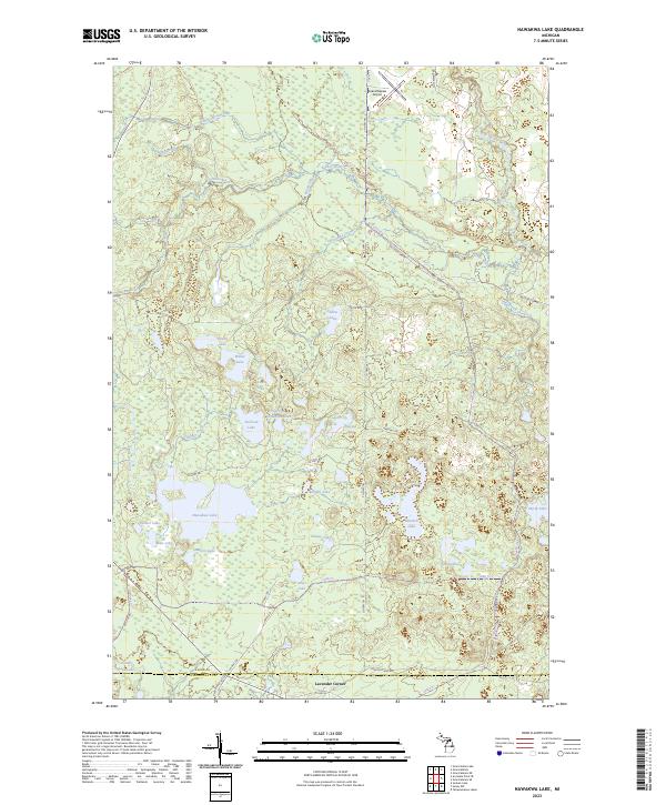
2023 Map of Nawakwa Lake
USGS Topo · Published 2023About this map
Lavender Corner marks the southern edge of this landscape in the Upper Peninsula, where the border of Alger and Schoolcraft counties crosses near County Line Lake. The terrain is defined by an intricate network of glacial lakes and wetlands, centered around the expansive Nawakwa Lake. Numerous smaller bodies of water such as Newton Lake, Bluegill Lake, and Sullivan Lake dot the interior, connected by a web of named creeks like Sullivan Creek and Blood Creek. The Sucker River meanders through the northern sections, passing beneath the Mccloud Grade. Transportation is limited to a handful of forest roads and trails, including Sagin Rd and Harding Trl, serving the Grand Marais Airport in the northeast. This 2023 survey illustrates a quiet, water-dominated environment characterized by timber management and recreation near the Lake Superior watershed.
Find a feature on this map
48 named features on this map. Tap any name to fly to it.
Don’t see what you’re looking for? This feature index may not catch every label — zoom into the map to look around manually.
Map Details
Editions of this 2023 Nawakwa Lake Map
This is the sole edition of this map. No revisions or reprints were ever made.
Other maps of this area

1931 · Seney NW
USGS Topo · 1:31,680

1931 · Driggs Lake NE
USGS Topo · 1:31,680

1954 · Sault Sainte Marie
USGS Topo · 1:250,000

1956 · Sault Sainte Marie
USGS Topo · 1:250,000

1957 · Sault Sainte Marie
USGS Topo · 1:250,000

1958 · Sault Sainte Marie
USGS Topo · 1:250,000

1958 · Marquette
USGS Topo · 1:250,000

1960 · Marquette
USGS Topo · 1:250,000

1961 · Marquette
USGS Topo · 1:250,000

1966 · Au Sable Point SE
USGS Topo · 1:24,000