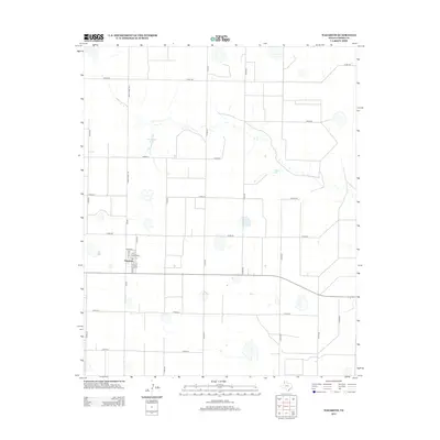
2012 Map of Nazareth
USGS Topo · Published 2012About this map
The settlement of Nazareth anchors this high plains survey of Castro County, revealing a grid of rural ranch roads and isolated water features characteristic of the Texas Panhandle. The town center is detailed with residential streets including Dunne St, S St Marys St, and 1st Ave, showing the concentrated footprint of the community. A significant local landmark, the Holy Family Cem, is located on the western edge of the town proper. Beyond the residential grid, the landscape is defined by the ephemeral presence of Schwalker Lake and Cosby Lake, along with numerous unnamed depressions that highlight the region's unique hydrology. The transportation network is dominated by north-south corridors like Ranch Road 168 and FM-168, which connect this agricultural hub to the surrounding plains.
Find a feature on this map
27 named features on this map. Tap any name to fly to it.
Don’t see what you’re looking for? This feature index may not catch every label — zoom into the map to look around manually.
Map Details
Editions of this 2012 Nazareth Map
This is the sole edition of this map. No revisions or reprints were ever made.
Other maps of this area

1954 · Plainview
USGS Topo · 1:250,000

1954 · Clovis
USGS Topo · 1:250,000

1958 · Clovis
USGS Topo · 1:250,000

1958 · Plainview
USGS Topo · 1:250,000

1963 · Hart NW
USGS Topo · 1:24,000

1965 · Hart
USGS Topo · 1:24,000

1965 · Lakeview
USGS Topo · 1:24,000

1965 · Nazareth SW
USGS Topo · 1:24,000

1965 · Nazareth
USGS Topo · 1:24,000

1965 · Center Plains School
USGS Topo · 1:24,000