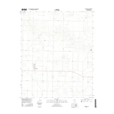
2016 Map of Nazareth
USGS Topo · Published 2016About this map
Nazareth serves as the central hub of this Castro County landscape, situated atop the High Plains at the intersection of FM 168 and Highway 86. The settlement is defined by its grid of local streets, including S St Marys St and N 1st St, and is anchored by the Holy Family Cem, which provides a vital touchstone for local genealogical research. The surrounding terrain is marked by the distinct depressions of the Llano Estacado, where ephemeral water bodies like Schwalker Lake and Cosby Lake collect seasonal runoff. To the north and east, the topography is carved by the winding course of Middle Tule Draw, which drains the agricultural tablelands. The map reveals a highly structured rural environment, dominated by a precise network of county roads that facilitate the region's ranching and farming operations.
Find a feature on this map
23 named features on this map. Tap any name to fly to it.
Don’t see what you’re looking for? This feature index may not catch every label — zoom into the map to look around manually.
Map Details
Editions of this 2016 Nazareth Map
This is the sole edition of this map. No revisions or reprints were ever made.
Other maps of this area

1954 · Plainview
USGS Topo · 1:250,000

1954 · Clovis
USGS Topo · 1:250,000

1958 · Clovis
USGS Topo · 1:250,000

1958 · Plainview
USGS Topo · 1:250,000

1963 · Hart NW
USGS Topo · 1:24,000

1965 · Hart
USGS Topo · 1:24,000

1965 · Lakeview
USGS Topo · 1:24,000

1965 · Nazareth SW
USGS Topo · 1:24,000

1965 · Nazareth
USGS Topo · 1:24,000

1965 · Center Plains School
USGS Topo · 1:24,000