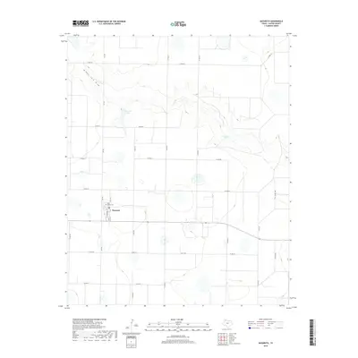
2019 Map of Nazareth
USGS Topo · Published 2019About this map
The settlement of Nazareth occupies a centralized location in this corner of the Texas Panhandle, serving as a primary hub for the surrounding agricultural landscape. The town's grid is clearly defined by streets such as S St Marys St and 2nd St, with the Holy Family Cem located on the northern edge of the community. This 2019 survey illustrates the characteristic High Plains topography, where seasonal water features like Middle Tule Draw and localized depressions such as Schwalker Lake and Cosby Lake punctuate the vast, flat terrain. An extensive network of county roads, including Co RD 610 and Co RD 614, provides a detailed look at the rural section lines and transport routes that have defined land use in Castro County for generations.
Find a feature on this map
25 named features on this map. Tap any name to fly to it.
Don’t see what you’re looking for? This feature index may not catch every label — zoom into the map to look around manually.
Map Details
Editions of this 2019 Nazareth Map
This is the sole edition of this map. No revisions or reprints were ever made.
Other maps of this area

1954 · Plainview
USGS Topo · 1:250,000

1954 · Clovis
USGS Topo · 1:250,000

1958 · Clovis
USGS Topo · 1:250,000

1958 · Plainview
USGS Topo · 1:250,000

1963 · Hart NW
USGS Topo · 1:24,000

1965 · Hart
USGS Topo · 1:24,000

1965 · Lakeview
USGS Topo · 1:24,000

1965 · Nazareth SW
USGS Topo · 1:24,000

1965 · Nazareth
USGS Topo · 1:24,000

1965 · Center Plains School
USGS Topo · 1:24,000