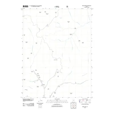
2011 Map of Nebo Basin
USGS Topo · Published 2011About this map
Devils Kitchen stands as a central geographic landmark within this high-elevation landscape of the Uinta National Forest. The drainage patterns on this sheet are defined by several major forks, including Nebo Creek and the southern reach of Salt Creek, which follows the corridor of Salt Creek Canyon Rd. The area is characterized by significant topographic relief, from the heights of North Peak and Evans Ridge down to the basins of Nebo Basin and Middle Basin. Local recreation sites such as Cottonwood Campground, Ponderosa Campground, and the Bear Canyon Picnic Area indicate the long-standing use of these canyons for outdoor access. Notable named features like Beer Bottle Spring and Red Rock Pasture suggest a history of seasonal ranching and local nomenclature tied to the rugged terrain of Utah County.
Find a feature on this map
53 named features on this map. Tap any name to fly to it.
Don’t see what you’re looking for? This feature index may not catch every label — zoom into the map to look around manually.
Map Details
Editions of this 2011 Nebo Basin Map
This is the sole edition of this map. No revisions or reprints were ever made.
Other maps of this area

1885 · Manti
USGS Topo · 1:250,000

1895 · Manti
USGS Topo · 1:250,000

1951 · Moroni
USGS Topo · 1:62,500

1951 · Santaquin
USGS Topo · 1:62,500

1951 · Nephi
USGS Topo · 1:62,500

1952 · Santaquin Peak
USGS Topo · 1:62,500

1956 · Price
USGS Topo · 1:250,000

1960 · Price
USGS Topo · 1:250,000

1962 · Price
USGS Topo · 1:250,000
1979 · Payson Lakes
USGS Topo · 1:24,000