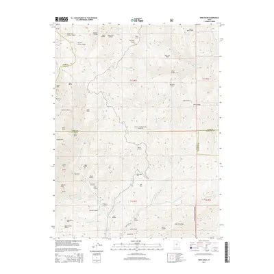
2014 Map of Nebo Basin
USGS Topo · Published 2014About this map
Uinta National Forest lands dominate this part of the Wasatch Range, where the high-altitude terrain is carved by complex drainages like Santaquin Canyon and Black Canyon. The area is characterized by dramatic topographic features such as North Peak and the geological amphitheater known as Devils Kitchen. Local history and recreation are centered around the canyon access points, with sites like Cottonwood Campground and Bear Canyon Picnic Area providing base points for exploring the surrounding ridges. Diverse hydrological systems flow through these heights, including Salt Creek and the Left Fork Slab Creek, which define the deep ravines between Evans Ridge and Bear Trap Ridge. The map illustrates a landscape primarily shaped by natural watercourses and the management of public forest lands along the intersection of Utah, Juab, and Sanpete counties.
Find a feature on this map
70 named features on this map. Tap any name to fly to it.
Don’t see what you’re looking for? This feature index may not catch every label — zoom into the map to look around manually.
Map Details
Editions of this 2014 Nebo Basin Map
This is the sole edition of this map. No revisions or reprints were ever made.
Other maps of this area

1885 · Manti
USGS Topo · 1:250,000

1895 · Manti
USGS Topo · 1:250,000

1951 · Moroni
USGS Topo · 1:62,500

1951 · Santaquin
USGS Topo · 1:62,500

1951 · Nephi
USGS Topo · 1:62,500

1952 · Santaquin Peak
USGS Topo · 1:62,500

1956 · Price
USGS Topo · 1:250,000

1960 · Price
USGS Topo · 1:250,000

1962 · Price
USGS Topo · 1:250,000
1979 · Payson Lakes
USGS Topo · 1:24,000