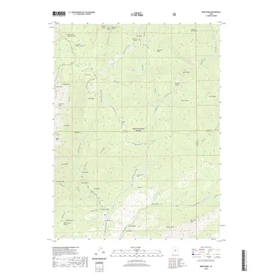
2020 Map of Nebo Basin
USGS Topo · Published 2020About this map
The high ridges of the Uinta National Forest dominate this landscape, where the borders of Utah, Juab, and Sanpete Counties meet. A network of deep drainages and steep slopes is defined by features like Santaquin Canyon and the massive depression of Hell Hole Basin. The terrain shows a distinct pattern of seasonal land use, marked by the Nebo Loop Winter (Snow) route and high-altitude pastures such as Red Rock Pasture and Upper Pasture.
Find a feature on this map
64 named features on this map. Tap any name to fly to it.
Don’t see what you’re looking for? This feature index may not catch every label — zoom into the map to look around manually.
Map Details
Editions of this 2020 Nebo Basin Map
This is the sole edition of this map. No revisions or reprints were ever made.
Other maps of this area

1885 · Manti
USGS Topo · 1:250,000

1895 · Manti
USGS Topo · 1:250,000

1951 · Moroni
USGS Topo · 1:62,500

1951 · Santaquin
USGS Topo · 1:62,500

1951 · Nephi
USGS Topo · 1:62,500

1952 · Santaquin Peak
USGS Topo · 1:62,500

1956 · Price
USGS Topo · 1:250,000

1960 · Price
USGS Topo · 1:250,000

1962 · Price
USGS Topo · 1:250,000
1979 · Payson Lakes
USGS Topo · 1:24,000