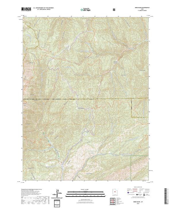
2023 Map of Nebo Basin
USGS Topo · Published 2023About this map
The Mount Nebo Wilderness and Uinta National Forest dominate this high-elevation terrain where the borders of Utah, Juab, and Sanpete counties converge. This map documents a landscape defined by significant basins and ridges, including the namesake Nebo Basin, Hell Hole Basin, and North Basin situated beneath Evans Ridge. The drainage system is complex, featuring the upper reaches of Salt Creek, Nebo Creek, and Red Creek, which flow through steep corridors like Black Canyon and Bear Canyon. A network of backcountry routes such as the Nebo Loop Winter Trl, Blackhawk Trl, and Summit Trl provides the primary access to these remote heights. Local landmarks like Mahogany Hill and Red Creek Flat reflect the traditional mountain use of the Wasatch Range, while the presence of Red Rock Pasture and Upper Pasture indicates the seasonal grazing patterns that have persisted in these highlands for generations.
Find a feature on this map
64 named features on this map. Tap any name to fly to it.
Don’t see what you’re looking for? This feature index may not catch every label — zoom into the map to look around manually.
Map Details
Editions of this 2023 Nebo Basin Map
This is the sole edition of this map. No revisions or reprints were ever made.
Other maps of this area

1885 · Manti
USGS Topo · 1:250,000

1895 · Manti
USGS Topo · 1:250,000

1951 · Moroni
USGS Topo · 1:62,500

1951 · Santaquin
USGS Topo · 1:62,500

1951 · Nephi
USGS Topo · 1:62,500

1952 · Santaquin Peak
USGS Topo · 1:62,500

1956 · Price
USGS Topo · 1:250,000

1960 · Price
USGS Topo · 1:250,000

1962 · Price
USGS Topo · 1:250,000
1979 · Payson Lakes
USGS Topo · 1:24,000