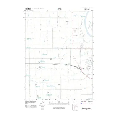
2010 Map of Nebraska City NW
USGS Topo · Published 2010About this map
Wyoming and the surrounding Otoe County landscape reveal an intricate system of water management and local landmarks in the early 21st century. The terrain is defined by the numerous catchments of the Wilson Creek Reservoir system, including reservoirs 5-H, 6-7, and 7-9, which are distributed across the western and central portions of the map. These engineering features are interspersed among small settlements like Elberon and the northern outskirts of Nebraska City, where the Wildwood Golf Course and Table Creek Golf Course mark the transition from rural to suburban land use.
Find a feature on this map
66 named features on this map. Tap any name to fly to it.
Don’t see what you’re looking for? This feature index may not catch every label — zoom into the map to look around manually.
Map Details
Editions of this 2010 Nebraska City NW Map
This is the sole edition of this map. No revisions or reprints were ever made.
Other maps of this area

1903 · Weeping Water
USGS Topo · 1:125,000

1907 · Nebraska City
USGS Topo · 1:62,500

1929 · Weeping Water
USGS Topo · 1:125,000

1935 · Nehawka
USGS Topo · 1:48,000

1940 · Nehawka
USGS Topo · 1:62,500

1955 · Nebraska City
USGS Topo · 1:250,000

1955 · Lincoln
USGS Topo · 1:250,000

1957 · Nebraska City
USGS Topo · 1:250,000

1957 · Lincoln
USGS Topo · 1:250,000

1958 · Lincoln
USGS Topo · 1:250,000