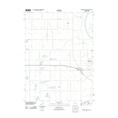
2011 Map of Nebraska City NW
USGS Topo · Published 2011About this map
Cowles Cemetery sits amidst the agricultural grid northwest of Nebraska City, marking a landscape defined by organized water management and traditional Midwestern farming. This 2011 survey illustrates a sophisticated network of flood control and irrigation, evidenced by a dense concentration of reservoirs and dams along the watershed. Named features like Wilson Creek Reservoir 6-4 and Wilson Creek Reservoir 5-H dominate the western portion of the map, while the Missouri River establishes the eastern boundary. The presence of settlements like Wyoming and Elberon alongside recreation sites such as Camp Catron and Wildwood Golf Course reflects the multi-use nature of the Otoe County countryside. This transition from the riparian bluffs of the Missouri to the upland drainage basins of Big Slough and Wolf Creek highlights the engineering efforts required to stabilize the fertile prairie soil.
Find a feature on this map
69 named features on this map. Tap any name to fly to it.
Don’t see what you’re looking for? This feature index may not catch every label — zoom into the map to look around manually.
Map Details
Editions of this 2011 Nebraska City NW Map
This is the sole edition of this map. No revisions or reprints were ever made.
Other maps of this area

1903 · Weeping Water
USGS Topo · 1:125,000

1907 · Nebraska City
USGS Topo · 1:62,500

1929 · Weeping Water
USGS Topo · 1:125,000

1935 · Nehawka
USGS Topo · 1:48,000

1940 · Nehawka
USGS Topo · 1:62,500

1955 · Nebraska City
USGS Topo · 1:250,000

1955 · Lincoln
USGS Topo · 1:250,000

1957 · Nebraska City
USGS Topo · 1:250,000

1957 · Lincoln
USGS Topo · 1:250,000

1958 · Lincoln
USGS Topo · 1:250,000