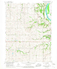
1966 Map of Nebraska City NW
USGS Topo · Published 1967About this map
The Steam Wagon Road traverses this landscape west of Nebraska City, marking a historic transportation corridor across the hills of Otoe County. During the mid-1960s, this area supported a network of rural education, evidenced by structures such as Ferguson Sch, Sunnyside Sch, and Baker Sch. To the north, the small settlement of Wyoming sits near the drainage of Wolf Creek, while the southern portion of the map is defined by the Chicago and North Western and Burlington Missouri River railroad lines passing through Elberon.
Find a feature on this map
35 named features on this map. Tap any name to fly to it.
Don’t see what you’re looking for? This feature index may not catch every label — zoom into the map to look around manually.
Map Details
Editions of this 1966 Nebraska City NW Map
This is the sole edition of this map. No revisions or reprints were ever made.
Other maps of this area

1903 · Weeping Water
USGS Topo · 1:125,000

1907 · Nebraska City
USGS Topo · 1:62,500

1929 · Weeping Water
USGS Topo · 1:125,000

1935 · Nehawka
USGS Topo · 1:48,000

1940 · Nehawka
USGS Topo · 1:62,500

1955 · Nebraska City
USGS Topo · 1:250,000

1955 · Lincoln
USGS Topo · 1:250,000

1957 · Nebraska City
USGS Topo · 1:250,000

1957 · Lincoln
USGS Topo · 1:250,000

1958 · Lincoln
USGS Topo · 1:250,000