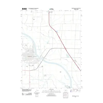
2011 Map of Nebraska City
USGS Topo · Published 2011About this map
The Missouri River carves a winding path through this 2011 survey, separating Nebraska City from the flat agricultural expanses of Iowa. The map documents a dense concentration of local heritage sites, including Wyuka Cemetery and Saint Marys Cemetery on the Nebraska side, while the lowlands across the river feature smaller settlements like Percival and Payne. This area shows a transition from the urban grid of the county seat to the sprawling bottomlands where Frazers Island sits in the main channel.
Find a feature on this map
46 named features on this map. Tap any name to fly to it.
Don’t see what you’re looking for? This feature index may not catch every label — zoom into the map to look around manually.
Map Details
Editions of this 2011 Nebraska City Map
This is the sole edition of this map. No revisions or reprints were ever made.
Other maps of this area

1907 · Nebraska City
USGS Topo · 1:62,500

1935 · Nehawka
USGS Topo · 1:48,000

1939 · Hamburg
USGS Topo · 1:62,500

1940 · Nehawka
USGS Topo · 1:62,500

1941 · Hamburg
USGS Topo · 1:62,500

1955 · Nebraska City
USGS Topo · 1:250,000

1957 · Nebraska City
USGS Topo · 1:250,000

1957 · Tabor SW
USGS Topo · 1:24,000

1958 · Nebraska City
USGS Topo · 1:250,000
1966 · Nebraska City NW
USGS Topo · 1:24,000