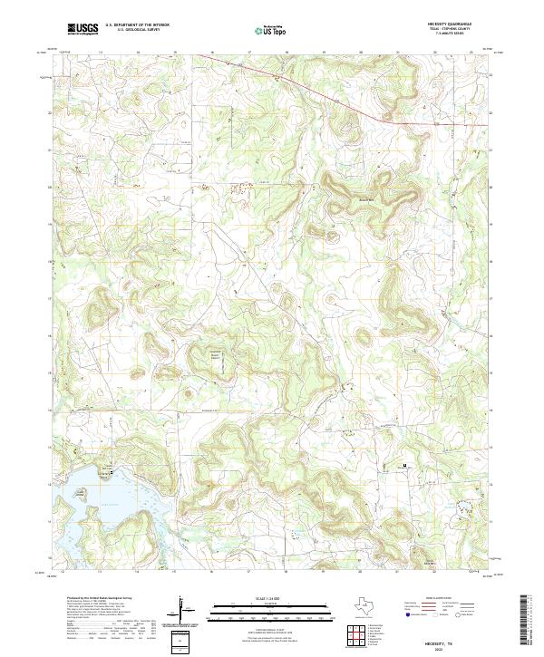
2022 Map of Necessity
USGS Topo · Published 2022About this map
Gunsolus Creek and its diverse tributaries define this Stephens County landscape, flowing through a region where livestock ranching and water management shape the modern terrain. The southern portion of the map is dominated by the expansive Lake Daniel, featuring Goat Island and the elevated Cemetery Point. These water bodies are complemented by smaller impoundments like J M Erambo Lake and Lake Necessity, illustrating the importance of local reservoirs in the arid Texas climate.
Find a feature on this map
36 named features on this map. Tap any name to fly to it.
Don’t see what you’re looking for? This feature index may not catch every label — zoom into the map to look around manually.
Map Details
Editions of this 2022 Necessity Map
This is the sole edition of this map. No revisions or reprints were ever made.
Other maps of this area

1890 · Breckenridge
USGS Topo · 1:125,000

1931 · Ivan
USGS Topo · 1:62,500

1954 · Abilene
USGS Topo · 1:250,000

1958 · Abilene
USGS Topo · 1:250,000

1958 · Breckenridge
USGS Topo · 1:24,000

1961 · Buck Mountain
USGS Topo · 1:24,000
1967 · Wayland
USGS Topo · 1:24,000

1967 · Necessity
USGS Topo · 1:24,000
1967 · Harpersville
USGS Topo · 1:24,000
1967 · Grand Lake
USGS Topo · 1:24,000