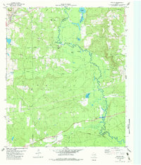
1982 Map of Neches
USGS Topo · Published 1982About this map
The Neches River carves a winding path along the boundary between Anderson and Cherokee counties, creating a landscape of sloughs and oxbow lakes such as Alligator Lake and Horseshoe Lake. In the early 1980s, this area remained defined by its rural settlements and the vital infrastructure of the Missouri Pacific and Texas State Railroad. The community of Neches sits in the northwest, near the elevated terrain of Daly Mtn, while small hamlets like Jarvis and Stills dot the southern landscape. For genealogists, the map preserves the locations of local burial grounds including Caldwell Cem and White Oak Cem, along with the Fields Chapel church. The prevalence of Oil Wells and a Pumping Sta reflect the region's mid-century petroleum development, contrasting with the undeveloped wetlands of Buzzard Slough and Deadwater Lake.
Find a feature on this map
41 named features on this map. Tap any name to fly to it.
Don’t see what you’re looking for? This feature index may not catch every label — zoom into the map to look around manually.
Map Details
Editions of this 1982 Neches Map
2 editions found
Other maps of this area

1949 · Palestine
USGS Topo · 1:62,500

1950 · Palestine
USGS Topo · 1:62,500

1951 · Elkhart
USGS Topo · 1:62,500

1951 · Jacksonville
USGS Topo · 1:62,500

1952 · Slocum
USGS Topo · 1:62,500

1953 · Palestine
USGS Topo · 1:250,000

1957 · Palestine
USGS Topo · 1:250,000

1981 · Palestine
USGS Topo · 1:100,000
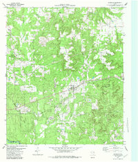
1982 · Maydelle
USGS Topo · 1:24,000
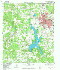
1982 · Jacksonville West
USGS Topo · 1:24,000