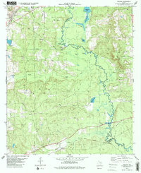
1982 Map of Neches
USGS Topo · Published 1982About this map
The Neches River forms a winding border between Anderson and Cherokee counties, carving a complex landscape of wetlands and oxbows in the East Texas piney woods. In the early 1980s, this area supported a mix of small rail-side settlements and rural energy development, evidenced by the numerous Oil Wells and a Gas Well scattered across the central terrain. The community of Neches sits at a strategic junction near Daly Mtn, served by the Missouri Pacific and Southern Pacific railroads.
Find a feature on this map
45 named features on this map. Tap any name to fly to it.
Don’t see what you’re looking for? This feature index may not catch every label — zoom into the map to look around manually.
Map Details
Editions of this 1982 Neches Map
2 editions found
Other maps of this area

1949 · Palestine
USGS Topo · 1:62,500

1950 · Palestine
USGS Topo · 1:62,500

1951 · Elkhart
USGS Topo · 1:62,500

1951 · Jacksonville
USGS Topo · 1:62,500

1952 · Slocum
USGS Topo · 1:62,500

1953 · Palestine
USGS Topo · 1:250,000

1957 · Palestine
USGS Topo · 1:250,000

1981 · Palestine
USGS Topo · 1:100,000
1982 · Maydelle
USGS Topo · 1:24,000
1982 · Jacksonville West
USGS Topo · 1:24,000