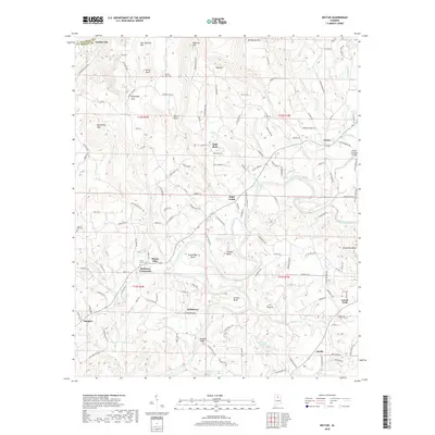
2018 Map of Nectar
USGS Topo · Published 2018About this map
The Locust Fork of the Black Warrior River carves a serpentine path through this Blount County landscape, creating dramatic meanders such as Standridge Bend and Johnson Bend. This terrain is defined by a series of prominent elevations, including Wornock Mtn and Hog Mtn, which frame small communities and family coves. Settled pockets like McAnnally Cove and Guinn Cove are tucked between the ridges, while the town of Nectar serves as a local hub near the landmark Nectar Covered Bridge. Local history is anchored by several rural burial grounds and meeting points, including the Union Grove Cem near Mount Olive and the intersection at Harkness Crossroads. The map records a complex network of local roads such as Sky Ball Rd and Wet Cat Rd that connect these upland settlements to the river valley.
Find a feature on this map
143 named features on this map. Tap any name to fly to it.
Don’t see what you’re looking for? This feature index may not catch every label — zoom into the map to look around manually.
Map Details
Editions of this 2018 Nectar Map
This is the sole edition of this map. No revisions or reprints were ever made.
Other maps of this area

1888 · Cullman
USGS Topo · 1:125,000

1889 · Birmingham
USGS Topo · 1:125,000

1892 · Cullman
USGS Topo · 1:125,000

1892 · Birmingham
USGS Topo · 1:125,000

1895 · Birmingham
USGS Topo · 1:125,000

1907 · Birmingham
USGS Topo · 1:125,000

1951 · Warrior
USGS Topo · 1:24,000

1951 · Blount Springs
USGS Topo · 1:24,000

1953 · Birmingham
USGS Topo · 1:250,000

1956 · Birmingham
USGS Topo · 1:250,000