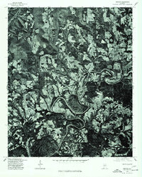
1975 Map of Nectar
USGS Topo · Published 1977About this map
The winding course of the Locust Fork dominates this 1970s orthophotoquad, slicing through the timbered hills of Blount County. This specific imagery, prepared from aerial photography taken in late 1975, reveals the interplay between the deep river meanders and the fragmented clearings of rural agriculture and homesteads. The small community of Nectar appears at the center of a network of winding county roads, showing the settlement pattern of the era before significant modern expansion. Unlike standard topographic maps, this photographic view provides direct visual evidence of land use, forest cover, and the specific footprint of rural residences in and around Locust and Ville. It is a practical resource for researchers looking to verify exact building locations or field boundaries as they existed in the mid-1970s.
Find a feature on this map
4 named features on this map. Tap any name to fly to it.
Don’t see what you’re looking for? This feature index may not catch every label — zoom into the map to look around manually.
Map Details
Editions of this 1975 Nectar Map
This is the sole edition of this map. No revisions or reprints were ever made.
Other maps of this area

1888 · Cullman
USGS Topo · 1:125,000

1889 · Birmingham
USGS Topo · 1:125,000

1892 · Cullman
USGS Topo · 1:125,000

1892 · Birmingham
USGS Topo · 1:125,000

1895 · Birmingham
USGS Topo · 1:125,000

1907 · Birmingham
USGS Topo · 1:125,000

1951 · Warrior
USGS Topo · 1:24,000

1951 · Blount Springs
USGS Topo · 1:24,000

1953 · Birmingham
USGS Topo · 1:250,000

1956 · Birmingham
USGS Topo · 1:250,000