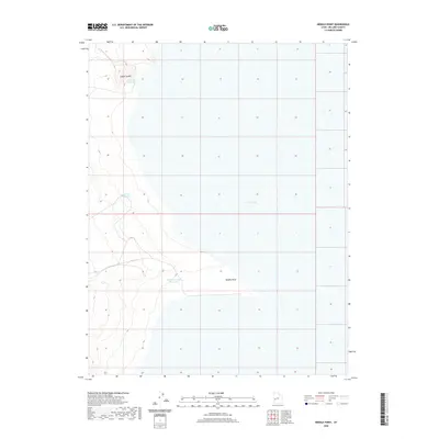
2020 Map of Needle Point
USGS Topo · Published 2020About this map
Sevier Lake dominates the eastern half of this arid Millard County landscape, defining a region where water management is central to the land's utility. The western terrain rises toward the distinct landforms of Coyote Knolls and the namesake Needle Point, a prominent feature overlooking the basin. This 2020 survey illustrates a sparsely developed desert environment where artificial catchments like Madsen Reservoir, Needle Reservoir, and the Needle Hardpan Reservoir provide critical collection points in an otherwise dry expanse. The transition from the flat lakebed to the western elevations reveals the subtle topography of the Great Basin, where low-lying hardpans and reservoirs mark the few points of human modification in a vast, open territory.
Find a feature on this map
6 named features on this map. Tap any name to fly to it.
Don’t see what you’re looking for? This feature index may not catch every label — zoom into the map to look around manually.
Map Details
Editions of this 2020 Needle Point Map
This is the sole edition of this map. No revisions or reprints were ever made.
Other maps of this area

1908 · Fish Springs
USGS Topo · 1:250,000

1910 · Fish Springs
USGS Topo · 1:250,000

1953 · Richfield
USGS Topo · 1:250,000

1953 · Delta
USGS Topo · 1:250,000

1958 · Richfield
USGS Topo · 1:250,000

1958 · Delta
USGS Topo · 1:250,000

1960 · Notch Peak
USGS Topo · 1:62,500

1960 · The Barn
USGS Topo · 1:62,500

1962 · Delta
USGS Topo · 1:250,000

1972 · Headlight Mtn
USGS Topo · 1:24,000