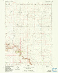
1960 Map of Needle Rock
USGS Topo · Published 1993About this map
Needle Rock and other prominent sandstone formations dominate this high plains landscape in Goshen County during the mid-century. The map captures a transition from the rolling drainage of Corn Creek and Josh Creek in the north to the more dramatic topography of Jackson Canyon and Josh Canyon in the south. This area is characterized by scattered family operations, including the Otto Ranch, Hunter Ranch, and Wilkins Ranch, which represent the enduring ranching economy of the region.
Find a feature on this map
14 named features on this map. Tap any name to fly to it.
Don’t see what you’re looking for? This feature index may not catch every label — zoom into the map to look around manually.
Map Details
Editions of this 1960 Needle Rock Map
3 editions found
Other maps of this area

1899 · Goshen Hole
USGS Topo · 1:125,000

1954 · Cheyenne
USGS Topo · 1:250,000

1958 · Cheyenne
USGS Topo · 1:250,000

1960 · Veteran
USGS Topo · 1:24,000

1960 · Diamond Flat
USGS Topo · 1:24,000

1960 · Hawk Springs
USGS Topo · 1:24,000

1960 · Needle Rock
USGS Topo · 1:24,000

1960 · Kessler Gap
USGS Topo · 1:24,000
1960 · Yoder
USGS Topo · 1:24,000

1963 · Y B O Canyon
USGS Topo · 1:24,000