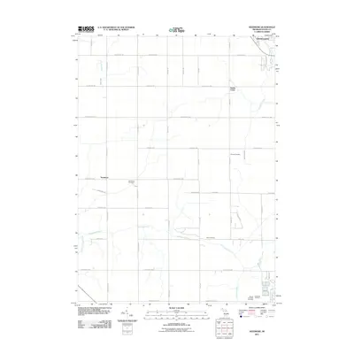
2011 Map of Needmore
USGS Topo · Published 2011About this map
Grand Ledge anchors the northeastern corner of this Eaton County landscape, where the meandering Sandstone Creek flows toward the city's outskirts. The region is defined by a dense grid of rural highways and county roads, reflecting a deeply rooted agricultural and residential settlement pattern. The small community of Needmore serves as a central landmark along W Needmore Hwy, while Oneida Center sits further north along Oneida Rd.
Find a feature on this map
44 named features on this map. Tap any name to fly to it.
Don’t see what you’re looking for? This feature index may not catch every label — zoom into the map to look around manually.
Map Details
Editions of this 2011 Needmore Map
This is the sole edition of this map. No revisions or reprints were ever made.
Other maps of this area

1910 · Lansing
USGS Topo · 1:62,500

1912 · Lansing
USGS Topo · 1:62,500

1927 · De Witt
USGS Topo · 1:62,500

1945 · Portland
USGS Topo · 1:62,500

1949 · Charlotte
USGS Topo · 1:62,500

1958 · Grand Rapids
USGS Topo · 1:250,000

1961 · Grand Rapids
USGS Topo · 1:250,000

1962 · Grand Rapids
USGS Topo · 1:250,000
1965 · Wacousta
USGS Topo · 1:24,000
1965 · Eaton Rapids
USGS Topo · 1:24,000