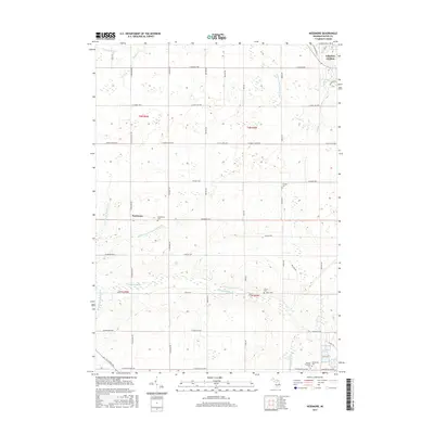
2017 Map of Needmore
USGS Topo · Published 2017About this map
The Thornapple River and its tributary, the Little Thornapple River, carve through this central Eaton County landscape, defining the local drainage patterns alongside several engineered waterways like the Patterson and Dubois Drain. The settlement of Needmore serves as a central focal point, situated at the intersection of Needmore Hwy and Cochran Rd. This area is characterized by a strong grid of rural roads and highways, including the E Saginaw Hwy and E Saint Joe Hwy, which connect the rural interior to the southwestern edge of Grand Ledge. Genealogists will find significant value in the documentation of several local burial grounds, including the Needmore Cem, Strange Cem, and Pinch Cem. The southern portion of the map transition toward Potterville Cem and the Benton Township Cem, illustrating the historical distribution of early family plots and community centers across the townships.
Find a feature on this map
51 named features on this map. Tap any name to fly to it.
Don’t see what you’re looking for? This feature index may not catch every label — zoom into the map to look around manually.
Map Details
Editions of this 2017 Needmore Map
This is the sole edition of this map. No revisions or reprints were ever made.
Other maps of this area

1910 · Lansing
USGS Topo · 1:62,500

1912 · Lansing
USGS Topo · 1:62,500

1927 · De Witt
USGS Topo · 1:62,500

1945 · Portland
USGS Topo · 1:62,500

1949 · Charlotte
USGS Topo · 1:62,500

1958 · Grand Rapids
USGS Topo · 1:250,000

1961 · Grand Rapids
USGS Topo · 1:250,000

1962 · Grand Rapids
USGS Topo · 1:250,000
1965 · Wacousta
USGS Topo · 1:24,000
1965 · Eaton Rapids
USGS Topo · 1:24,000