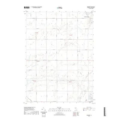
2019 Map of Needmore
USGS Topo · Published 2019About this map
Grand Ledge anchors the northeastern corner of this Eaton County survey, where the landscape transitions into the agricultural heartland surrounding the settlement of Needmore. The terrain is defined by a sophisticated network of water management features, including the Patterson and Dubois Drain, Cole Wright Helms Drain, and Wright Pardee Skinner Drain, which support the region's productive farm fields. These engineered waterways feed into natural systems like the Thornapple River and Sandstone Creek, illustrating a long-standing human effort to shape the local hydrology.
Find a feature on this map
54 named features on this map. Tap any name to fly to it.
Don’t see what you’re looking for? This feature index may not catch every label — zoom into the map to look around manually.
Map Details
Editions of this 2019 Needmore Map
This is the sole edition of this map. No revisions or reprints were ever made.
Other maps of this area

1910 · Lansing
USGS Topo · 1:62,500

1912 · Lansing
USGS Topo · 1:62,500

1927 · De Witt
USGS Topo · 1:62,500

1945 · Portland
USGS Topo · 1:62,500

1949 · Charlotte
USGS Topo · 1:62,500

1958 · Grand Rapids
USGS Topo · 1:250,000

1961 · Grand Rapids
USGS Topo · 1:250,000

1962 · Grand Rapids
USGS Topo · 1:250,000
1965 · Wacousta
USGS Topo · 1:24,000
1965 · Eaton Rapids
USGS Topo · 1:24,000