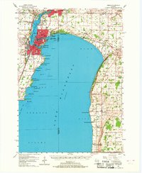
1955 Map of Neenah
USGS Topo · Published 1968About this map
Lake Winnebago dominates this mid-century landscape, where the Fox River flows through the industrial centers of Menasha and Neenah. The map captures a detailed snapshot of urban development on Doty Island, situated between the Little Lake Butte Des Morts and the main lake. Numerous parochial schools and institutions, such as St Marys Sch and St Elizabeth Hospital, reflect the community's established social infrastructure during the 1950s.
Find a feature on this map
98 named features on this map. Tap any name to fly to it.
Don’t see what you’re looking for? This feature index may not catch every label — zoom into the map to look around manually.
Map Details
Editions of this 1955 Neenah Map
3 editions found
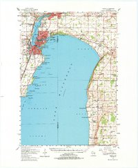
Other maps of this area

1910 · Fond du Lac
USGS Topo · 1:62,500

1911 · Neenah
USGS Topo · 1:62,500

1954 · De Pere
USGS Topo · 1:62,500

1954 · Chilton
USGS Topo · 1:62,500

1954 · Kiel
USGS Topo · 1:62,500

1955 · Neenah
USGS Topo · 1:62,500

1955 · Appleton
USGS Topo · 1:24,000

1955 · Appleton
USGS Topo · 1:62,500

1955 · Neenah
USGS Topo · 1:24,000

1955 · Fond Du Lac
USGS Topo · 1:62,500