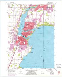
1955 Map of Neenah
USGS Topo · Published 1976About this map
Little Lake Butte Des Morts and the sprawling waters of Lake Winnebago dominate this mid-century look at the Fox River Valley. The urban centers of Neenah and Menasha are shown in dense detail, flanking the Menasha Channel and Neenah Channel that surround Doty Island. The industrial and transportation backbone of the era is evident through the convergence of the Chicago and North Western and other major rail lines serving the waterfront. Residential expansion is marked by numerous neighborhood institutions, including Roosevelt Sch, Nicolet Sch, and St Margaret Mary Sch. Along the eastern shore of the lake, recreational spots like Waverly Beach and Brighton Beach provide a contrast to the quarries and gravel pits found further inland. The map also identifies several legacy medical and religious sites such as St Elizabeth Hospital and the sprawling Oak Hill Cem.
Find a feature on this map
90 named features on this map. Tap any name to fly to it.
Don’t see what you’re looking for? This feature index may not catch every label — zoom into the map to look around manually.
Map Details
Editions of this 1955 Neenah Map
3 editions found
Other maps of this area

1911 · Neenah
USGS Topo · 1:62,500

1955 · Neenah
USGS Topo · 1:62,500

1955 · Appleton
USGS Topo · 1:24,000

1955 · Appleton
USGS Topo · 1:62,500

1955 · Neenah
USGS Topo · 1:24,000

1955 · Green Bay
USGS Topo · 1:250,000

1956 · New London
USGS Topo · 1:48,000

1961 · Oshkosh
USGS Topo · 1:24,000

1961 · Oshkosh
USGS Topo · 1:62,500

1961 · Oshkosh NE
USGS Topo · 1:24,000