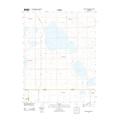
2013 Map of Neenoshe Reservoir
USGS Topo · Published 2013About this map
The high plains of eastern Colorado are defined by a complex network of man-made irrigation and storage systems in this 2013 survey. Dominating the landscape is the Neenoshe Reservoir, part of a larger chain of water management features including Neesopah Reservoir, Neeskah Reservoir, and Neegronda Reservoir. These basins, along with smaller bodies like Mud Lake and King Reservoir, reflect the critical importance of water storage in this arid region at the borders of Prowers, Kiowa, and Bent counties.
Find a feature on this map
33 named features on this map. Tap any name to fly to it.
Don’t see what you’re looking for? This feature index may not catch every label — zoom into the map to look around manually.
Map Details
Editions of this 2013 Neenoshe Reservoir Map
This is the sole edition of this map. No revisions or reprints were ever made.
Other maps of this area

1892 · Lamar
USGS Topo · 1:125,000

1954 · Lamar
USGS Topo · 1:250,000

1955 · McClave
USGS Topo · 1:24,000

1955 · May Valley
USGS Topo · 1:24,000

1955 · Wiley
USGS Topo · 1:24,000

1958 · Lamar
USGS Topo · 1:250,000

1967 · Neenoshe Reservoir
USGS Topo · 1:24,000
1968 · Alkali Lake
USGS Topo · 1:24,000
1968 · Chivington SE
USGS Topo · 1:24,000
1968 · Swede Lake
USGS Topo · 1:24,000