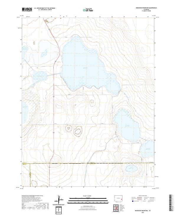
2022 Map of Neenoshe Reservoir
USGS Topo · Published 2022About this map
Neenoshe Reservoir anchors this high plains landscape at the intersection of Kiowa, Bent, and Prowers Counties. The region is defined by a sophisticated network of early 21st-century water management infrastructure, where expansive catchments like the Neeskah Reservoir and Neesopah Reservoir are linked by a system of man-made waterways. The Lone Wolf Canal, Comanche Canal, and Satanta Canal illustrate the intensive engineering required to sustain this arid environment. The map also captures smaller natural and semi-natural features like Mud Lake and the Neegronda Reservoir, providing a detailed look at the rural section lines and county road grids, such as Co RD H and Co RD A, that divide the townships of this southeastern Colorado borderland.
Find a feature on this map
32 named features on this map. Tap any name to fly to it.
Don’t see what you’re looking for? This feature index may not catch every label — zoom into the map to look around manually.
Map Details
Editions of this 2022 Neenoshe Reservoir Map
This is the sole edition of this map. No revisions or reprints were ever made.
Other maps of this area

1892 · Lamar
USGS Topo · 1:125,000

1954 · Lamar
USGS Topo · 1:250,000

1955 · McClave
USGS Topo · 1:24,000

1955 · May Valley
USGS Topo · 1:24,000

1955 · Wiley
USGS Topo · 1:24,000

1958 · Lamar
USGS Topo · 1:250,000

1967 · Neenoshe Reservoir
USGS Topo · 1:24,000
1968 · Alkali Lake
USGS Topo · 1:24,000
1968 · Chivington SE
USGS Topo · 1:24,000
1968 · Swede Lake
USGS Topo · 1:24,000