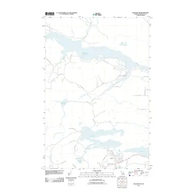
2011 Map of Negaunee SW
USGS Topo · Published 2011About this map
The Dead River Storage Basin and Deer Lake dominate this northern Michigan landscape, where the iron mining legacy of the Upper Peninsula is written into the local geography. Significant water bodies like Teal Lake and the Silver Mine Lakes reflect the industrial and natural history of the region. On the southern edge of the map, the northern limits of Ishpeming are marked by the Ishpeming Cemetery and Country Village RV Park, bordering the wetland environments of Lake Bacon and Little Lake. The area's hydrology is complex, featuring a network of tributaries including Gold Mine Creek, Zhulkie Creek, and the Little Dead River. This 2011 survey documents a mix of rural development along Deer Lake Rd and County Hwy GGL, providing a contemporary record of land use in Marquette County.
Find a feature on this map
50 named features on this map. Tap any name to fly to it.
Don’t see what you’re looking for? This feature index may not catch every label — zoom into the map to look around manually.
Map Details
Editions of this 2011 Negaunee SW Map
This is the sole edition of this map. No revisions or reprints were ever made.
Other maps of this area

1952 · Ishpeming
USGS Topo · 1:62,500

1952 · Ishpeming
USGS Topo · 1:24,000

1952 · Palmer
USGS Topo · 1:24,000

1953 · Negaunee
USGS Topo · 1:24,000

1954 · Negaunee SW
USGS Topo · 1:24,000

1954 · Negaunee
USGS Topo · 1:62,500

1955 · Diorite
USGS Topo · 1:24,000

1955 · Greenwood
USGS Topo · 1:24,000

1955 · Republic
USGS Topo · 1:62,500

1955 · Champion
USGS Topo · 1:62,500