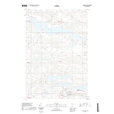
2019 Map of Negaunee SW
USGS Topo · Published 2019About this map
Ishpeming and Negaunee anchor the southern edge of this Marquette County landscape, where the iron-rich terrain of the Upper Peninsula meets a complex network of waterways. The northern half is dominated by the Dead River Storage Basin, a significant reservoir fed by Clark Cr and Willow Cr. This 2019 survey documents the modern layout of the Ishpeming Cem and local residential developments such as those near Teal Lake and Deer Lake. For outdoor researchers, the map traces the N Country National Scenic Trail as it winds through the timbered hills and wetlands between Silver Mine Lakes and Big Mud Lake. The drainage patterns of the Carp River and Little Dead River reveal the underlying geology that has long shaped the region's industry and settlement, from the historic town centers to the newer roads like Woodland Dr and Northbridge Ln.
Find a feature on this map
77 named features on this map. Tap any name to fly to it.
Don’t see what you’re looking for? This feature index may not catch every label — zoom into the map to look around manually.
Map Details
Editions of this 2019 Negaunee SW Map
This is the sole edition of this map. No revisions or reprints were ever made.
Other maps of this area

1952 · Ishpeming
USGS Topo · 1:62,500

1952 · Ishpeming
USGS Topo · 1:24,000

1952 · Palmer
USGS Topo · 1:24,000

1953 · Negaunee
USGS Topo · 1:24,000

1954 · Negaunee SW
USGS Topo · 1:24,000

1954 · Negaunee
USGS Topo · 1:62,500

1955 · Diorite
USGS Topo · 1:24,000

1955 · Greenwood
USGS Topo · 1:24,000

1955 · Republic
USGS Topo · 1:62,500

1955 · Champion
USGS Topo · 1:62,500