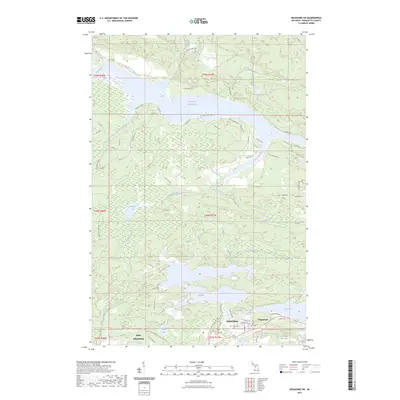
2023 Map of Negaunee SW
USGS Topo · Published 2023About this map
The iron mining legacy of Michigan's Upper Peninsula is etched into the landscape surrounding Ishpeming and Negaunee. This area, central to the Marquette Iron Range, is characterized by a complex network of waterways and early industrial landmarks. The northern reaches are dominated by the Dead River Storage Basin, where the Dead River flows through a series of reservoirs and smaller bodies like the Silver-Mine Lakes.
Find a feature on this map
77 named features on this map. Tap any name to fly to it.
Don’t see what you’re looking for? This feature index may not catch every label — zoom into the map to look around manually.
Map Details
Editions of this 2023 Negaunee SW Map
This is the sole edition of this map. No revisions or reprints were ever made.
Other maps of this area

1952 · Ishpeming
USGS Topo · 1:62,500

1952 · Ishpeming
USGS Topo · 1:24,000

1952 · Palmer
USGS Topo · 1:24,000

1953 · Negaunee
USGS Topo · 1:24,000

1954 · Negaunee SW
USGS Topo · 1:24,000

1954 · Negaunee
USGS Topo · 1:62,500

1955 · Diorite
USGS Topo · 1:24,000

1955 · Greenwood
USGS Topo · 1:24,000

1955 · Republic
USGS Topo · 1:62,500

1955 · Champion
USGS Topo · 1:62,500