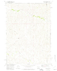
1972 Map of Negro Butte
USGS Topo · Published 1975About this map
Negro Butte rises above the high plains where Johnson and Campbell counties meet in northeast Wyoming. This 1972 survey documents a landscape defined by its vital water sources and subterranean resources, centered around the Beaver Creek Ranch and the winding course of Beaver Creek. The map records an extensive network of industrial and agricultural infrastructure, notably identifying specific water and mineral extraction points including Parker Well, Staley Well, and the School Section Well. The drainage patterns of Pumpkin Creek and Culp Draw illustrate the local topography as it supported ranching and early energy exploration during the Missouri River Basin development program. These specific named landmarks and the presence of a significant pipeline reveal the area's dual role as a traditional ranching territory and an emerging corridor for resource transport in the early 1970s.
Find a feature on this map
15 named features on this map. Tap any name to fly to it.
Don’t see what you’re looking for? This feature index may not catch every label — zoom into the map to look around manually.
Map Details
Editions of this 1972 Negro Butte Map
This is the sole edition of this map. No revisions or reprints were ever made.
Other maps of this area

1953 · Hoe Ranch
USGS Topo · 1:24,000

1953 · Fats Draw
USGS Topo · 1:24,000

1953 · The Nipple
USGS Topo · 1:24,000

1954 · Gillette
USGS Topo · 1:250,000

1955 · Newcastle
USGS Topo · 1:250,000

1955 · Sheridan
USGS Topo · 1:250,000

1955 · Arminto
USGS Topo · 1:250,000

1955 · Gillette
USGS Topo · 1:250,000

1958 · Gillette
USGS Topo · 1:250,000

1958 · Sheridan
USGS Topo · 1:250,000