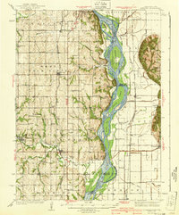
1940 Map of Nehawka
USGS Topo · Published 1940About this map
The Missouri River forms the central spine of this pre-war landscape, carving a wide path through the borderlands of Nebraska and Iowa. The river is characterized by complex features like Noddleman Island, Goose Island, and Auldon Bar, illustrating the shifting nature of the channel before major modern stabilization projects. To the west, the Nebraska upland is densely marked with the infrastructure of early 20th-century rural life, featuring a notable concentration of country schools such as Eightmile Grove Sch, Rock Creek Sch, and Swan Sch.
Find a feature on this map
56 named features on this map. Tap any name to fly to it.
Don’t see what you’re looking for? This feature index may not catch every label — zoom into the map to look around manually.
Map Details
Editions of this 1940 Nehawka Map
3 editions found
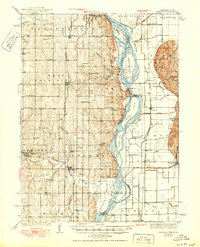
Other maps of this area

1893 · Fremont
USGS Topo · 1:125,000

1896 · Fremont
USGS Topo · 1:125,000

1903 · Weeping Water
USGS Topo · 1:125,000

1907 · Nebraska City
USGS Topo · 1:62,500

1929 · Weeping Water
USGS Topo · 1:125,000

1935 · Nehawka
USGS Topo · 1:48,000

1939 · Hamburg
USGS Topo · 1:62,500

1940 · Nehawka
USGS Topo · 1:62,500

1941 · Hamburg
USGS Topo · 1:62,500

1954 · Omaha
USGS Topo · 1:250,000