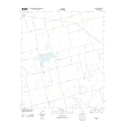
2012 Map of Neinda
USGS Topo · Published 2012About this map
Neinda and the southern edge of Hamlin define the settled landscape of this Jones County region during the early 21st century. The terrain is a network of rural routes like Co Rd 182 and FM-126, connecting scattered homesteads and agricultural plots. Water management and drainage are central to the geography here, anchored by South Lake and the winding course of Dry California Cr. Further south, the landscape transitions toward Boyds Chapel, while the distinctive rise of Skinout Mtn stands near the confluence of local drainages like Skinout Cr. This survey captures a moment of modern rural life in West Texas, showing the established farm-to-market road system and the intermittent creeks that characterize the plains east of the Brazos River forks.
Find a feature on this map
42 named features on this map. Tap any name to fly to it.
Don’t see what you’re looking for? This feature index may not catch every label — zoom into the map to look around manually.
Map Details
Editions of this 2012 Neinda Map
This is the sole edition of this map. No revisions or reprints were ever made.
Other maps of this area

1891 · Anson
USGS Topo · 1:125,000

1893 · Roby
USGS Topo · 1:125,000

1893 · Anson
USGS Topo · 1:125,000

1954 · Big Spring
USGS Topo · 1:250,000

1954 · Abilene
USGS Topo · 1:250,000

1957 · Hawley
USGS Topo · 1:62,500

1957 · Noodle
USGS Topo · 1:62,500

1958 · Big Spring
USGS Topo · 1:250,000

1958 · Abilene
USGS Topo · 1:250,000

1965 · Tuxedo
USGS Topo · 1:24,000