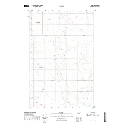
2017 Map of Nekoma NW
USGS Topo · Published 2017About this map
Loma occupies a central position within this Cavalier County landscape, characterized by the rigid Public Land Survey System grid that defines northeastern North Dakota. The terrain is marked by a high density of small wetlands and depressions, characteristic of the prairie pothole region, scattered across various townships including t161n r61w and t160n r60w. Transport and access are dictated by a precise network of gravel and section-line roads, such as 100th Ave NE and 92nd St NE, which facilitate the region's agricultural operations. In the northeast corner, Robertson Field serves as a lone localized landmark in an otherwise vast expanse of farmland and seasonal water bodies. The survey illustrates the intersection of modern rural development and the persistent, water-retentive natural drainage patterns of the northern plains.
Find a feature on this map
24 named features on this map. Tap any name to fly to it.
Don’t see what you’re looking for? This feature index may not catch every label — zoom into the map to look around manually.
Map Details
Editions of this 2017 Nekoma NW Map
This is the sole edition of this map. No revisions or reprints were ever made.
Other maps of this area

1953 · Devils Lake
USGS Topo · 1:250,000

1956 · Devils Lake
USGS Topo · 1:250,000

1967 · Langdon East
USGS Topo · 1:24,000

1970 · Loma
USGS Topo · 1:24,000

1970 · Alsen SE
USGS Topo · 1:24,000

1970 · Hannah SE
USGS Topo · 1:24,000

1970 · Langdon West
USGS Topo · 1:24,000

1972 · Nekoma
USGS Topo · 1:24,000

1972 · Easby
USGS Topo · 1:24,000

1972 · Billings Lake
USGS Topo · 1:24,000