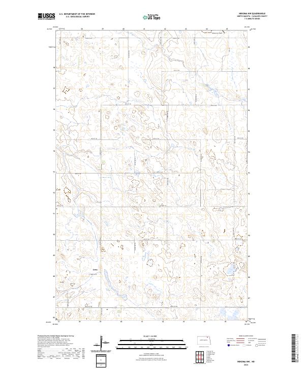
2024 Map of Nekoma NW
USGS Topo · Published 2024About this map
Loma stands as the primary settlement within this section of the Great Plains, situated at the intersection of 85th St NE and 100th Ave NE. The landscape is defined by the high density of prairie potholes and wetlands typical of the region, which are preserved in the southern portion of the quadrangle at the Cavalier County Waterfowl Production Area. This conservation site highlights the area's significance for migratory birds and local ecology. Further north, the terrain is partitioned by a rigid grid of section roads including 90th St NE and 105th Ave NE, illustrating the enduring impact of the Public Land Survey System on North Dakota's agricultural development. Isolated landmarks such as Robertson Field in the northeast corner punctuate the open expanse, while the extensive system of numbered avenues and streets provides a precise record of the rural infrastructure as it exists in the early twenty-first century.
Find a feature on this map
25 named features on this map. Tap any name to fly to it.
Don’t see what you’re looking for? This feature index may not catch every label — zoom into the map to look around manually.
Map Details
Editions of this 2024 Nekoma NW Map
This is the sole edition of this map. No revisions or reprints were ever made.
Other maps of this area

1953 · Devils Lake
USGS Topo · 1:250,000

1956 · Devils Lake
USGS Topo · 1:250,000

1967 · Langdon East
USGS Topo · 1:24,000

1970 · Loma
USGS Topo · 1:24,000

1970 · Alsen SE
USGS Topo · 1:24,000

1970 · Hannah SE
USGS Topo · 1:24,000

1970 · Langdon West
USGS Topo · 1:24,000

1972 · Nekoma
USGS Topo · 1:24,000

1972 · Easby
USGS Topo · 1:24,000

1972 · Billings Lake
USGS Topo · 1:24,000