2022 Map of Nekoosa
USGS Topo · Published 2022About this map
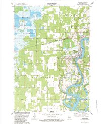
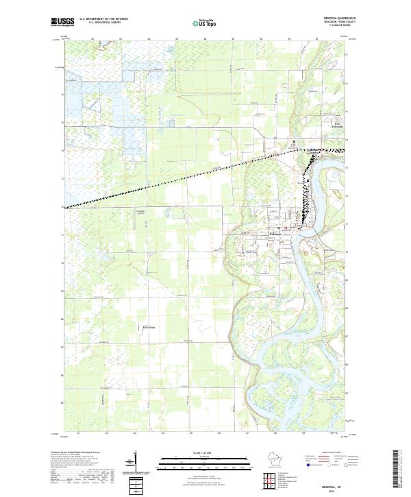
The Wisconsin River dominates the eastern half of this landscape, carving a winding path through Wood County as it passes the established settlements of Nekoosa and Port Edwards. The river's influence on the local geography is evident in the numerous tributaries and backwaters, including Ripple Cr, Moccasin Cr, and the wetlands surrounding Grass Lake. This 2022 survey illustrates the transition from the dense residential grid of Nekoosa, with its named streets like Market St and Wood Ave, to the more expansive rural lands to the west.
Find a feature on this map
47 named features on this map. Tap any name to fly to it.
Don’t see what you’re looking for? This feature index may not catch every label — zoom into the map to look around manually.
Map Details
Editions of this 2022 Nekoosa Map
This is the sole edition of this map. No revisions or reprints were ever made.