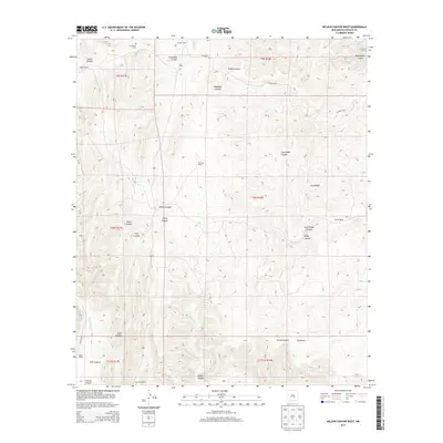
2013 Map of Nelson Canyon West
USGS Topo · Published 2013About this map
Escondido Cem serves as a central landmark in this high-elevation Lincoln County landscape, situated near the headwaters of Escondido Cr. The map reveals a land defined by deep drainage systems and family-held land, where operations like Sisneros Ranch, Old Fears Ranch, and Wood Ranch are positioned near the rims of complex canyon networks. The terrain is dominated by the massive Long Ridge, which separates significant geological depressions including Nelson Canyon, Deadman Canyon, and Diablo Canyon.
Find a feature on this map
35 named features on this map. Tap any name to fly to it.
Don’t see what you’re looking for? This feature index may not catch every label — zoom into the map to look around manually.
Map Details
Editions of this 2013 Nelson Canyon West Map
This is the sole edition of this map. No revisions or reprints were ever made.
Other maps of this area

1935 · Capitan Mountains
USGS Topo · 1:48,000

1936 · Arabela
USGS Topo · 1:48,000

1940 · Capitan Mountains
USGS Topo · 1:62,500

1942 · Arabela
USGS Topo · 1:62,500

1955 · Roswell
USGS Topo · 1:250,000

1958 · Roswell
USGS Topo · 1:250,000

1961 · Lincoln
USGS Topo · 1:62,500

1961 · Tinnie
USGS Topo · 1:62,500

1962 · Roswell
USGS Topo · 1:250,000
1981 · Granville Canyon
USGS Topo · 1:24,000