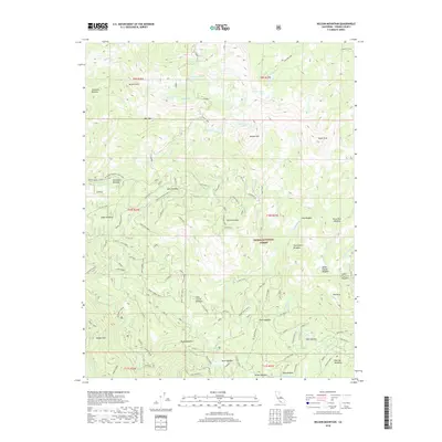
2018 Map of Nelson Mountain
USGS Topo · Published 2018About this map
Nelson Mtn and Bear Mtn dominate the high-altitude landscape of the Sierra National Forest in this 2018 topographic study. The area is defined by its seasonal hydrology and extensive system of meadows, which historically supported grazing and forestry operations. Named clearings such as Exchequer Meadow, Bear Meadow, and Cabin Meadow are linked by a network of specialized roads, including the Bear Creek Road and its various spurs.
Find a feature on this map
59 named features on this map. Tap any name to fly to it.
Don’t see what you’re looking for? This feature index may not catch every label — zoom into the map to look around manually.
Map Details
Editions of this 2018 Nelson Mountain Map
This is the sole edition of this map. No revisions or reprints were ever made.
Other maps of this area

1903 · Tehipite
USGS Topo · 1:125,000

1904 · Kaiser
USGS Topo · 1:125,000

1905 · Tehipite
USGS Topo · 1:125,000

1912 · Mt. Goddard
USGS Topo · 1:125,000

1922 · Trimmer
USGS Topo · 1:96,000

1924 · Dinuba
USGS Topo · 1:125,000

1947 · Mariposa
USGS Topo · 1:250,000

1948 · Fresno
USGS Topo · 1:250,000

1948 · Mariposa
USGS Topo · 1:250,000

1952 · Tehipite Dome
USGS Topo · 1:62,500