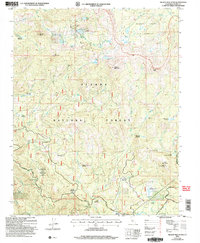
2004 Map of Nelson Mountain
USGS Topo · Published 2007About this map
Dinkey Lakes Wilderness and the Sierra National Forest dominate this high-altitude landscape in Fresno County, where a complex network of alpine lakes and meadows defines the terrain. The presence of a Quarry, Tailings, and a Prospect near Mud Lakes points to the area's history of mineral exploration, while the namesake Nelson Mountain and Eagle Peak overlook a series of namesake meadows including Huckleberry Meadow and Exchequer Meadow.
Find a feature on this map
69 named features on this map. Tap any name to fly to it.
Don’t see what you’re looking for? This feature index may not catch every label — zoom into the map to look around manually.
Map Details
Editions of this 2004 Nelson Mountain Map
This is the sole edition of this map. No revisions or reprints were ever made.
Other maps of this area

1903 · Tehipite
USGS Topo · 1:125,000

1904 · Kaiser
USGS Topo · 1:125,000

1905 · Tehipite
USGS Topo · 1:125,000

1912 · Mt. Goddard
USGS Topo · 1:125,000

1922 · Trimmer
USGS Topo · 1:96,000

1924 · Dinuba
USGS Topo · 1:125,000

1947 · Mariposa
USGS Topo · 1:250,000

1948 · Fresno
USGS Topo · 1:250,000

1948 · Mariposa
USGS Topo · 1:250,000

1952 · Tehipite Dome
USGS Topo · 1:62,500