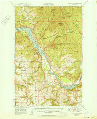
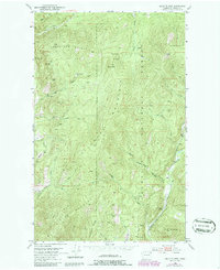
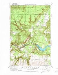
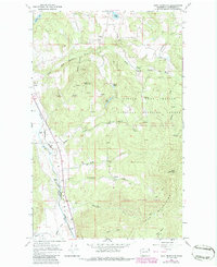
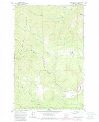
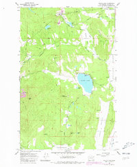
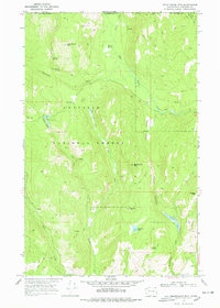
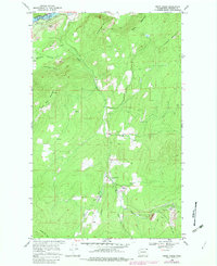
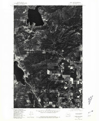
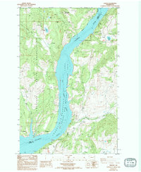
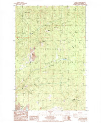
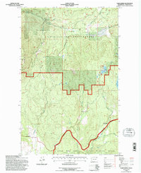
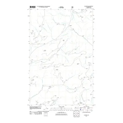
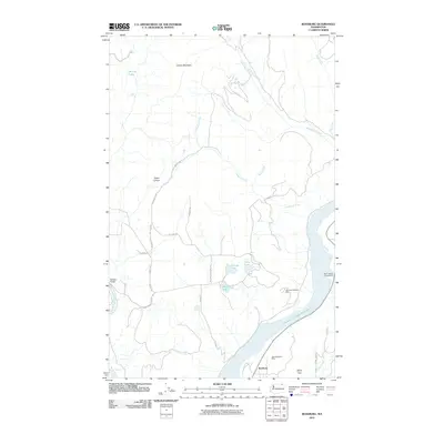
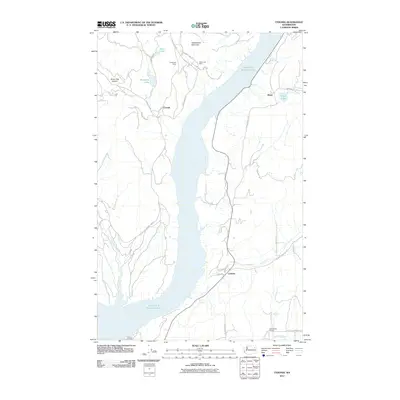
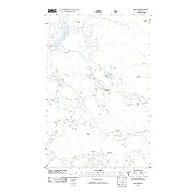
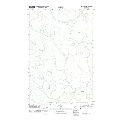
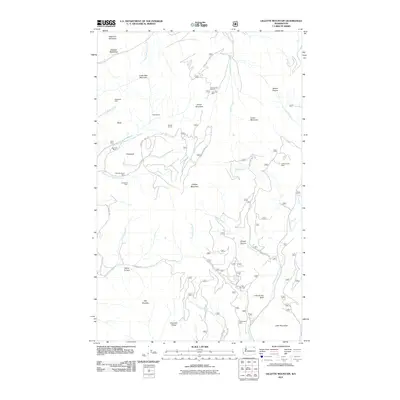
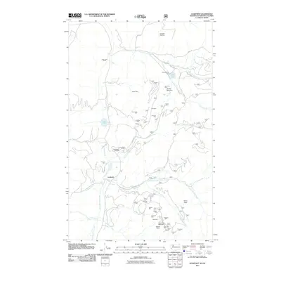
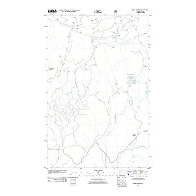
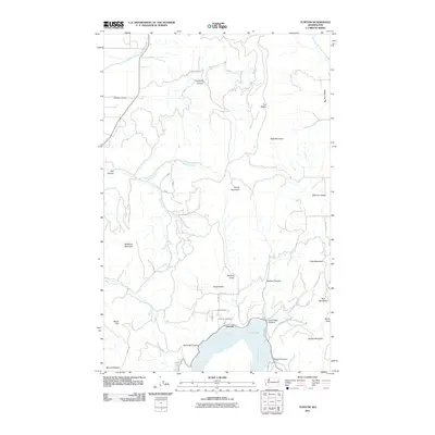
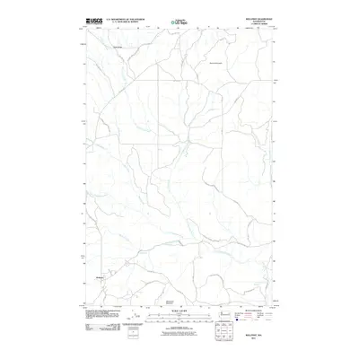
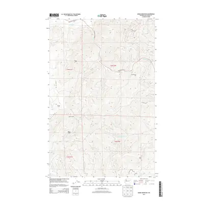
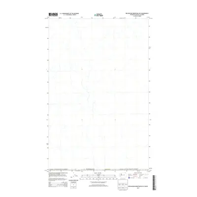
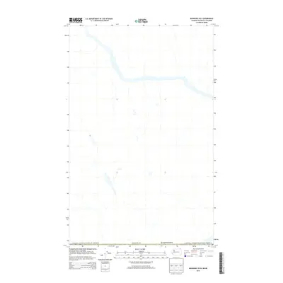
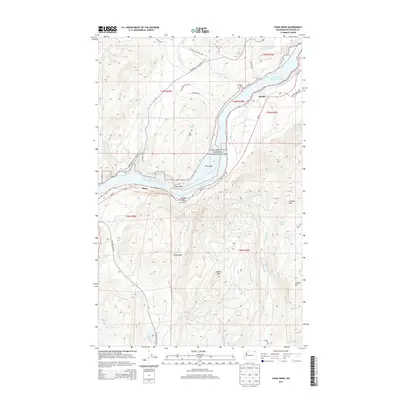
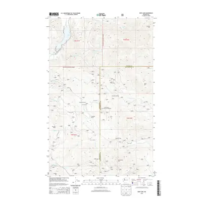
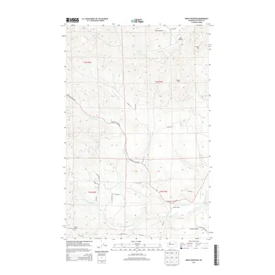
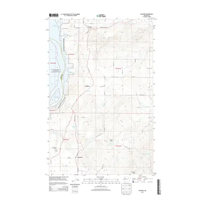
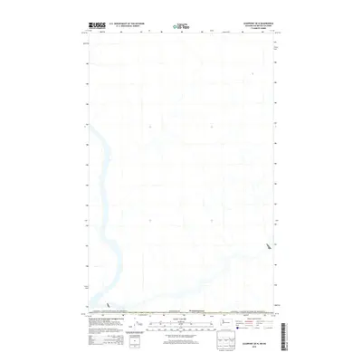
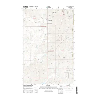
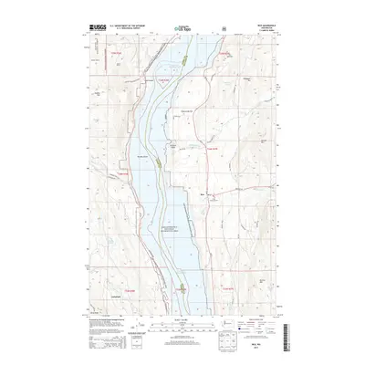
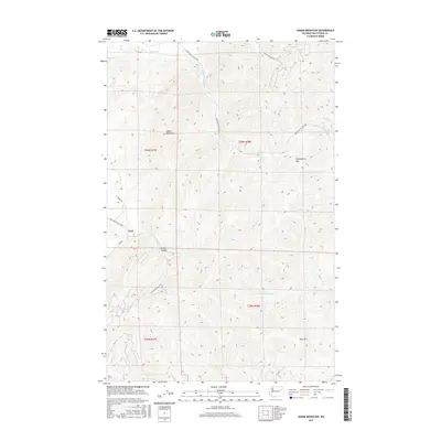
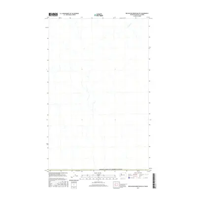
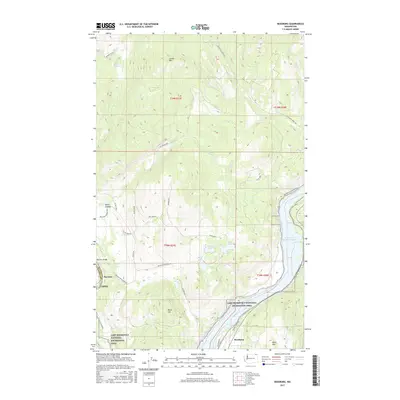
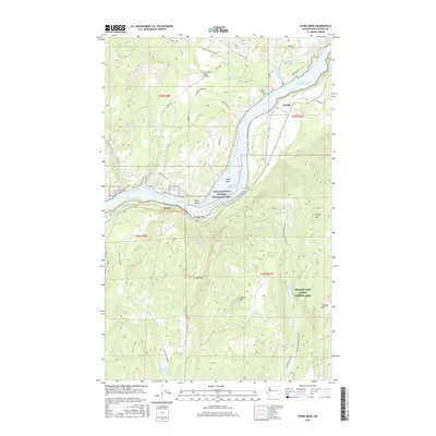
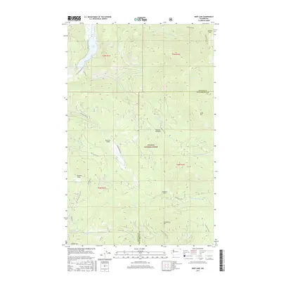
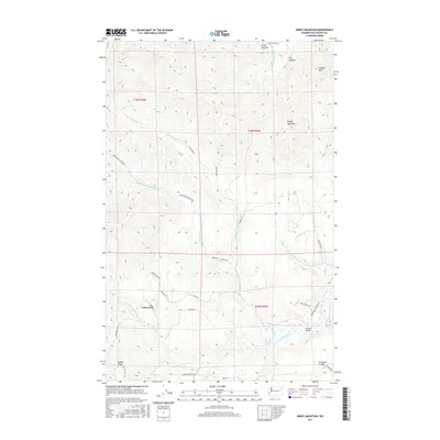
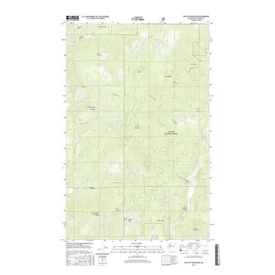
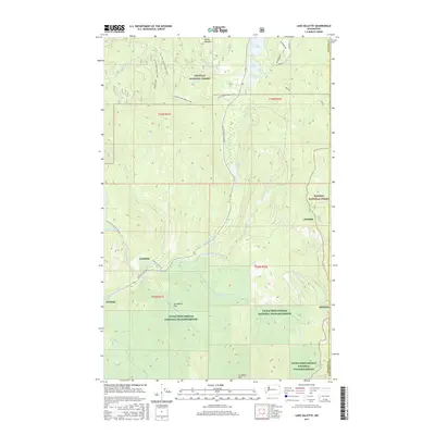
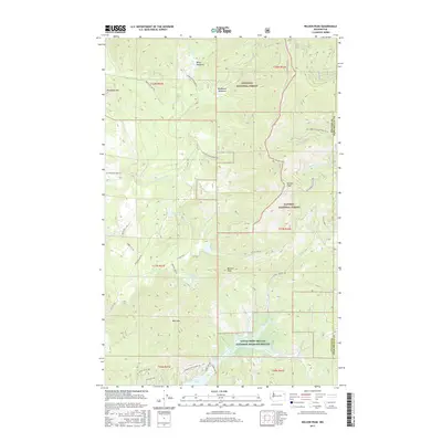
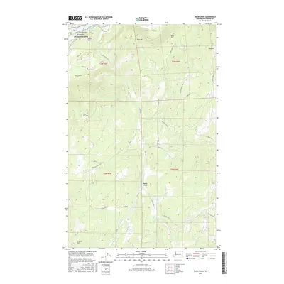
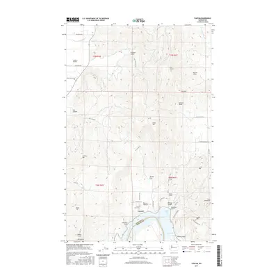
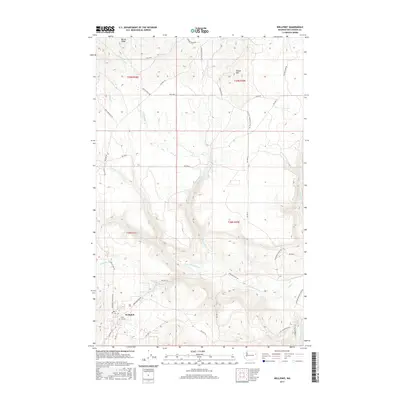
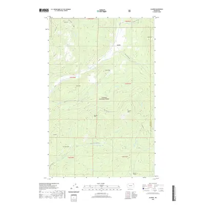
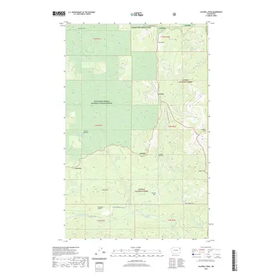
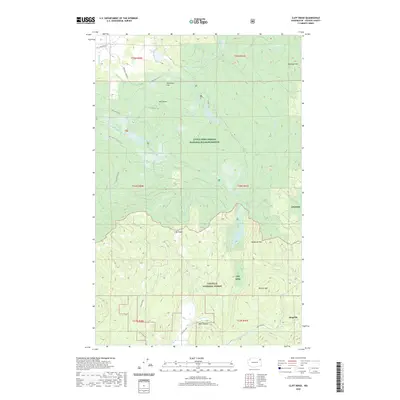
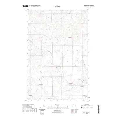
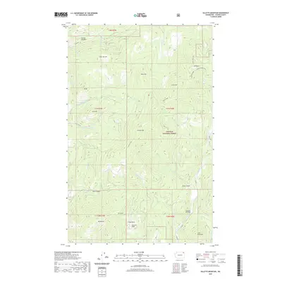
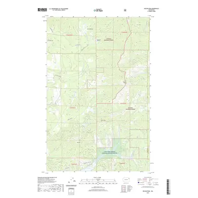
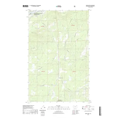
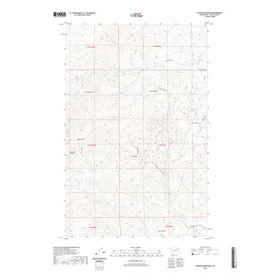
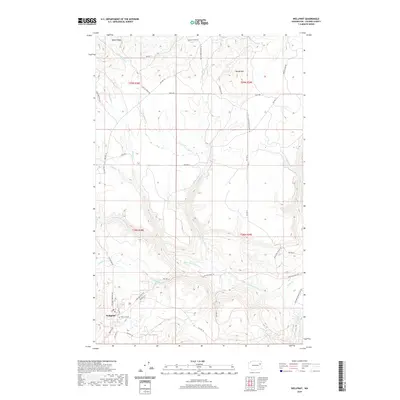
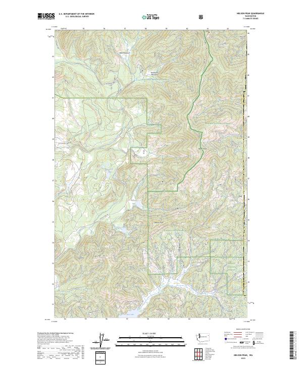
1965 Map of Nelson Peak
USGS Topo · Published 1967About this map
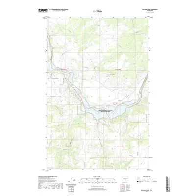
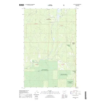
Colville National Forest and Kaniksu National Forest converge in this mid-1960s topographic survey of the Stevens and Pend Oreille county line. The landscape is defined by significant elevations, including Nelson Peak, Benson Peak, and Bald Mountain, with a series of small, isolated mountain lakes such as Buzzard Lake, Nelson Lake, and Benson Lake dotting the drainages. A network of primitive transportation routes, including the Upper Cottonwood Road and various unnamed jeep trails, provide access to higher ground and localized prospects indicating mineral exploration. In the lower elevations, water features like Deer Lake and the marshy expanses of Betts Meadows and Woodward Meadows characterize the transition from timbered slopes to basin floors. Cultural landmarks are sparse but specific, including Camp Hafer and the Kaniksu Ranch, showing the modest footprint of settlement and recreation in this heavily forested mountain region.
Find a feature on this map
23 named features on this map. Tap any name to fly to it.
Don’t see what you’re looking for? This feature index may not catch every label — zoom into the map to look around manually.
Map Details
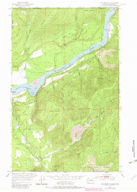
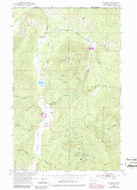
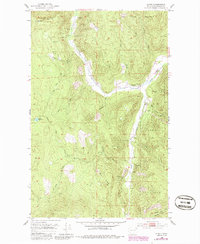
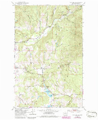
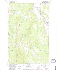
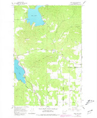
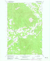
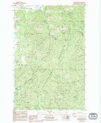
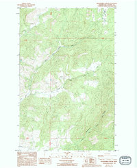
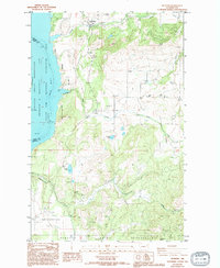
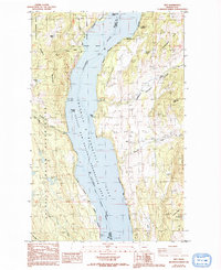
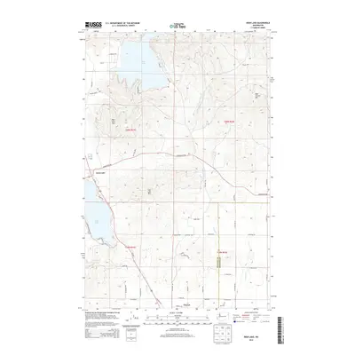
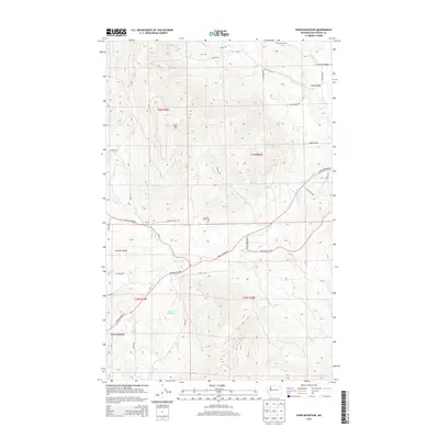
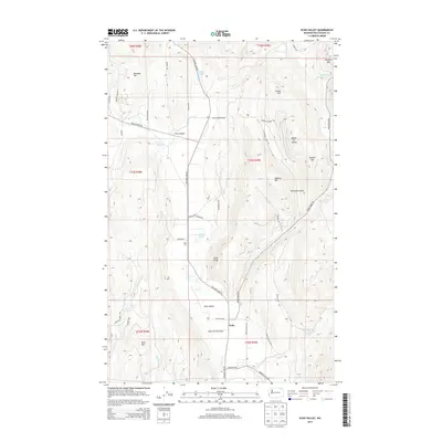
Editions of this 1965 Nelson Peak Map
Historical Maps of Stevens County Through Time
303 maps found

1944 Wellpinit
Stevens County, WA
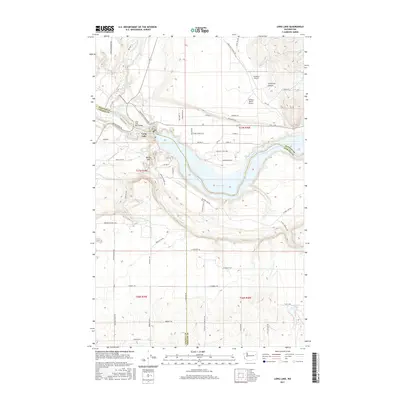
1948 Hunters
Stevens County, WA

1948 Turtle Lake
Stevens County, WA
1950 Hunters
Stevens County, WA
1950 Turtle Lake
Stevens County, WA

1952 Aladdin
Stevens County, WA
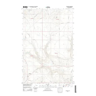
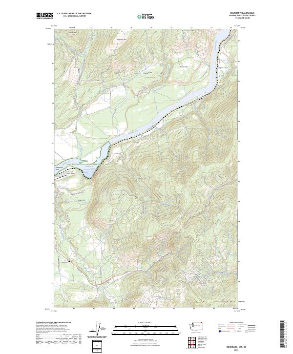
1952 Boundary
Stevens County, WA
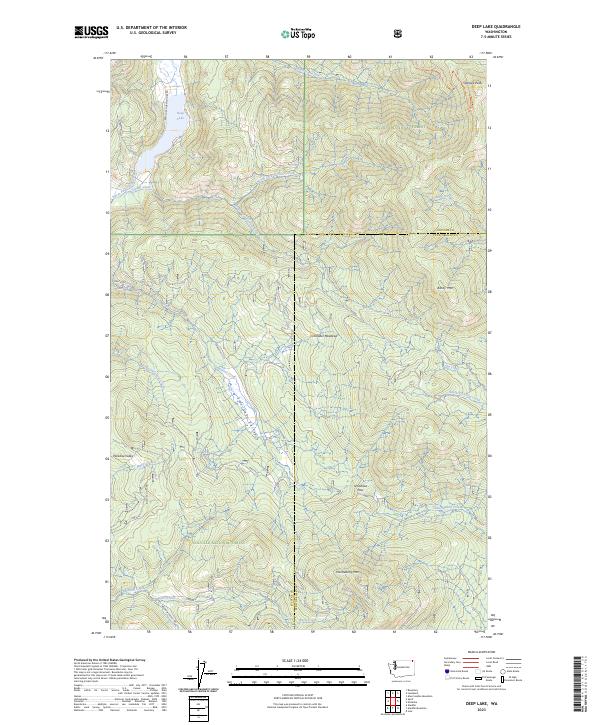
1952 Deep Lake
Stevens County, WA
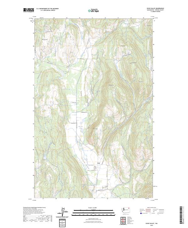
1952 Echo Valley
Stevens County, WA
1952 Gillette Mtn
Stevens County, WA
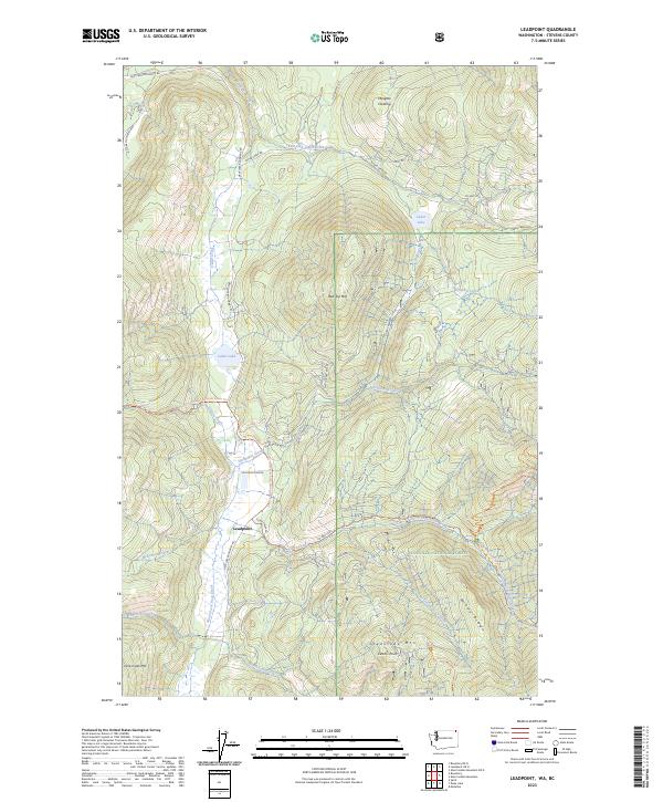
1952 Leadpoint
Stevens County, WA
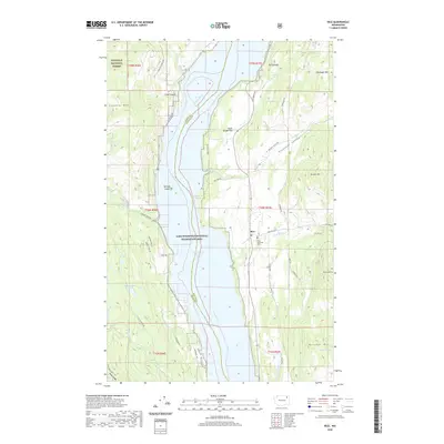
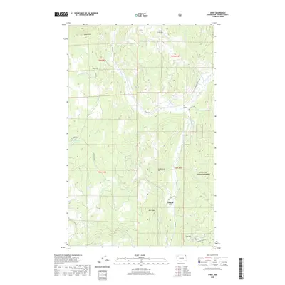
1952 Spirit
Stevens County, WA
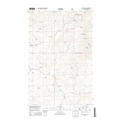
1952 White Mud Lake
Stevens County, WA
1953 Wellpinit
Stevens County, WA
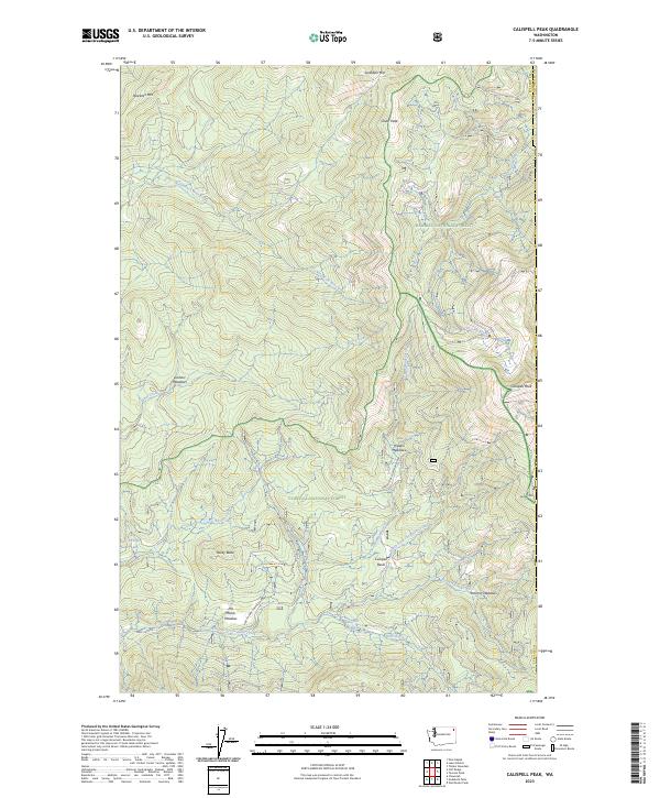
1964 Calispell Peak
Stevens County, WA

1964 Chewelah Mtn
Stevens County, WA
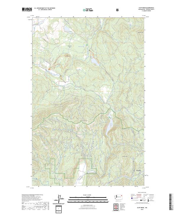
1964 Cliff Ridge
Stevens County, WA
1964 Goddards Peak
Stevens County, WA
1965 Addy Mountain
Stevens County, WA
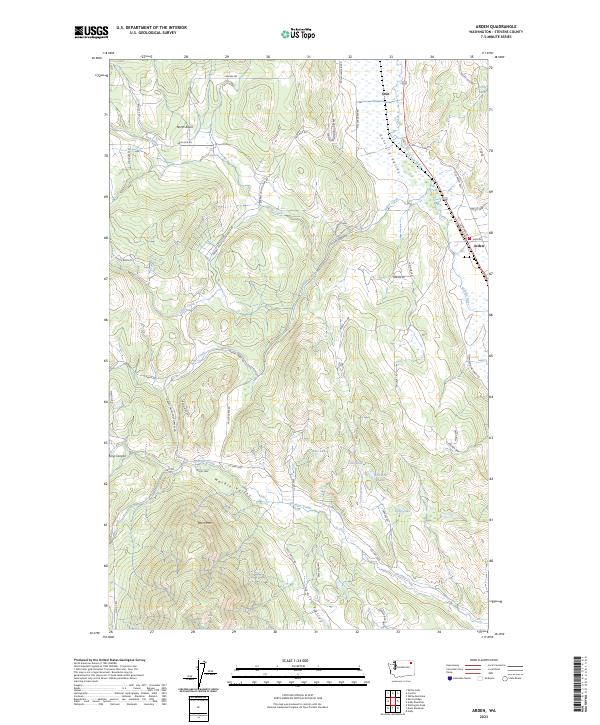
1965 Arden
Stevens County, WA
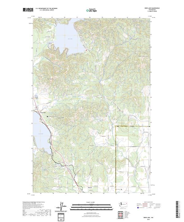
1965 Deer Lake
Stevens County, WA
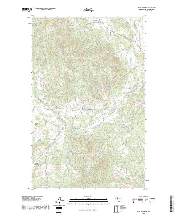
1965 Dunn Mountain
Stevens County, WA
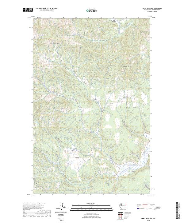
1965 Empey Mountain
Stevens County, WA
1965 Forest Center
Stevens County, WA
1965 Nelson Peak
Stevens County, WA
1965 Stensgar Mtn.
Stevens County, WA
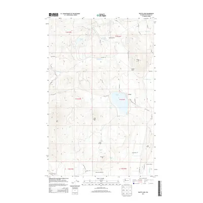
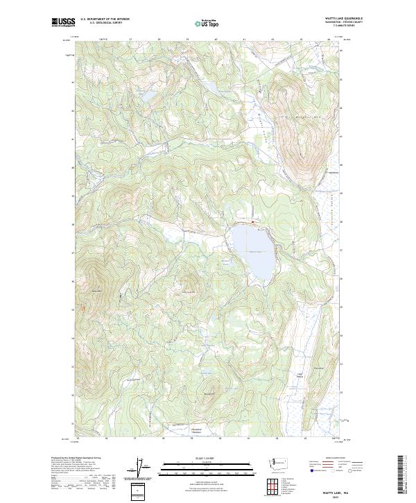
1965 Waitts Lake
Stevens County, WA
1966 Aladdin
Stevens County, WA
1966 Lake Gillette
Stevens County, WA
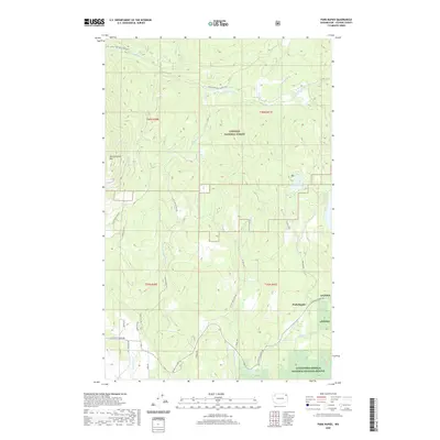
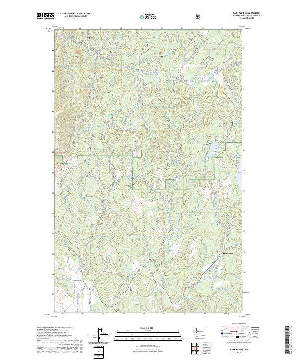
1967 Park Rapids
Stevens County, WA
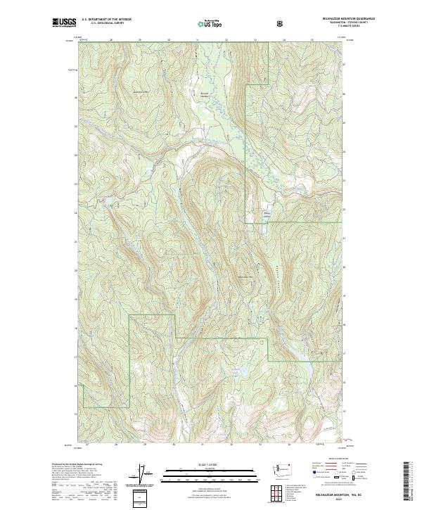
1969 Belshazzar Mtn
Stevens County, WA
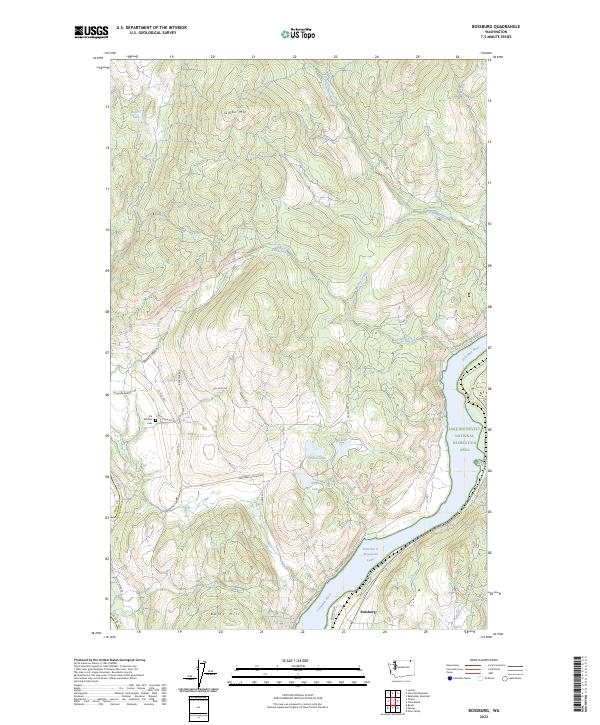
1969 Bossburg
Stevens County, WA
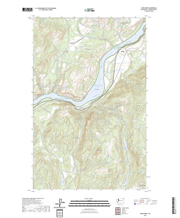
1969 China Bend
Stevens County, WA
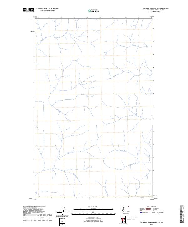
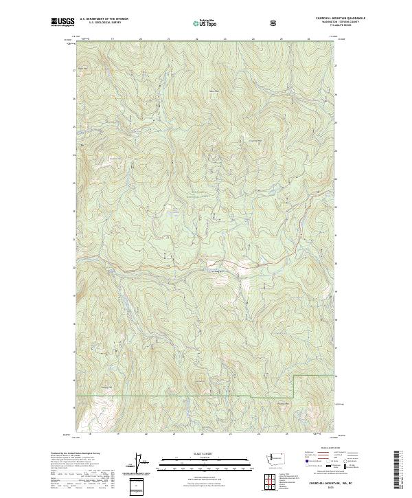
1969 Churchill Mtn
Stevens County, WA
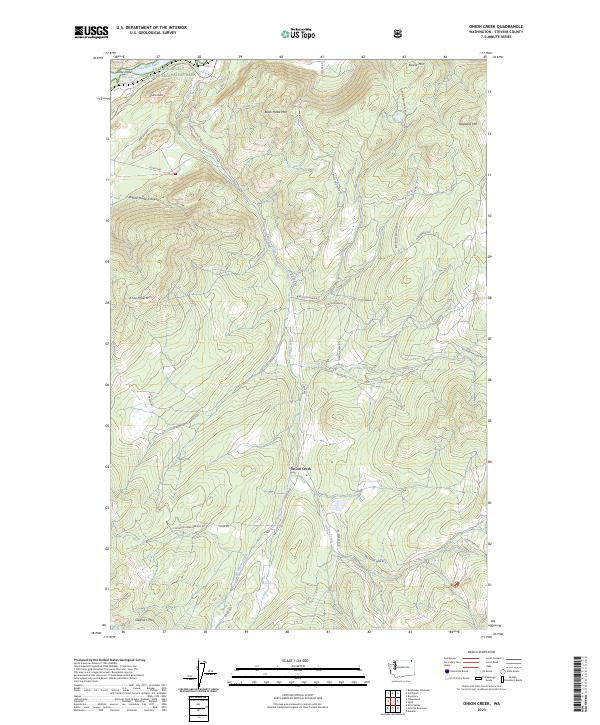
1969 Onion Creek
Stevens County, WA

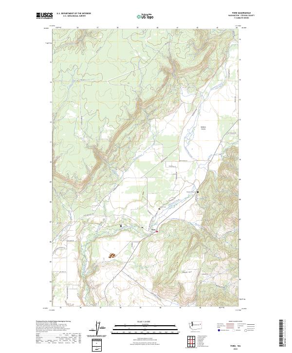
1973 Ford
Stevens County, WA

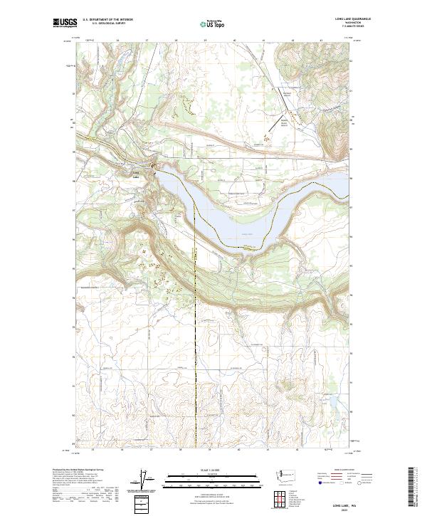
1973 Long Lake
Stevens County, WA

1973 Tumtum
Stevens County, WA

1973 Wellpinit
Stevens County, WA
1978 Deer Lake
Stevens County, WA

1980 Calispell Peak
Stevens County, WA
1985 Adams Mtn
Stevens County, WA

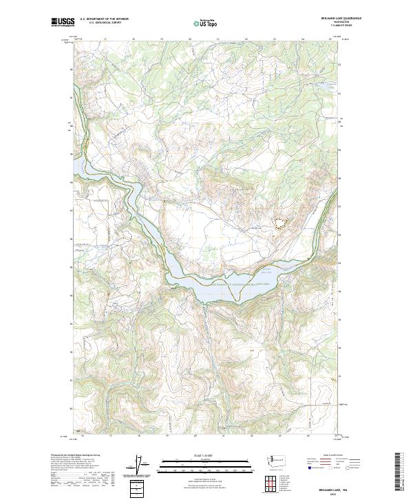
1985 Benjamin Lake
Stevens County, WA
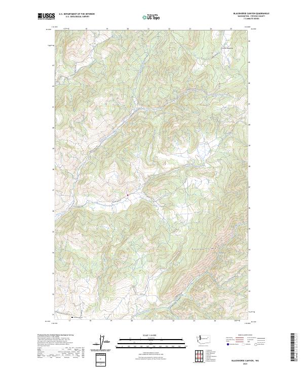
1985 Blackhorse Canyon
Stevens County, WA
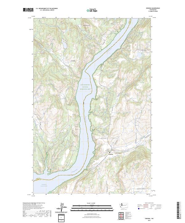
1985 Cedonia
Stevens County, WA

1985 Fort Spokane
Stevens County, WA
1985 Hunters
Stevens County, WA
1985 Kentry Ridge
Stevens County, WA

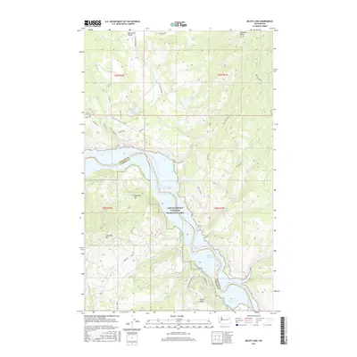
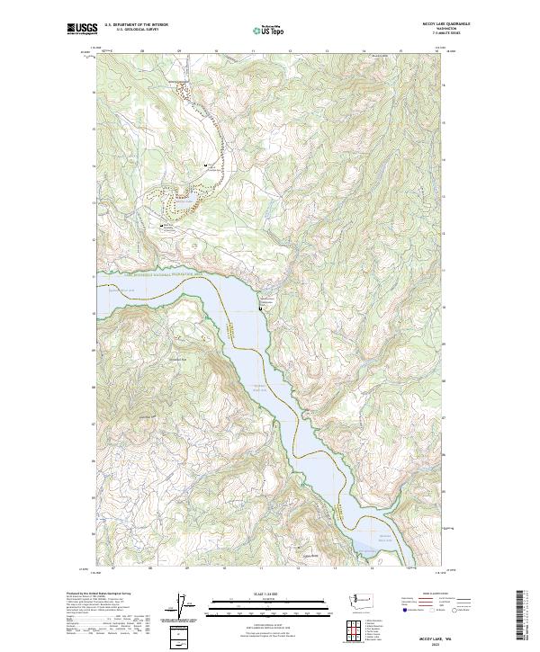
1985 Mc Coy Lake
Stevens County, WA
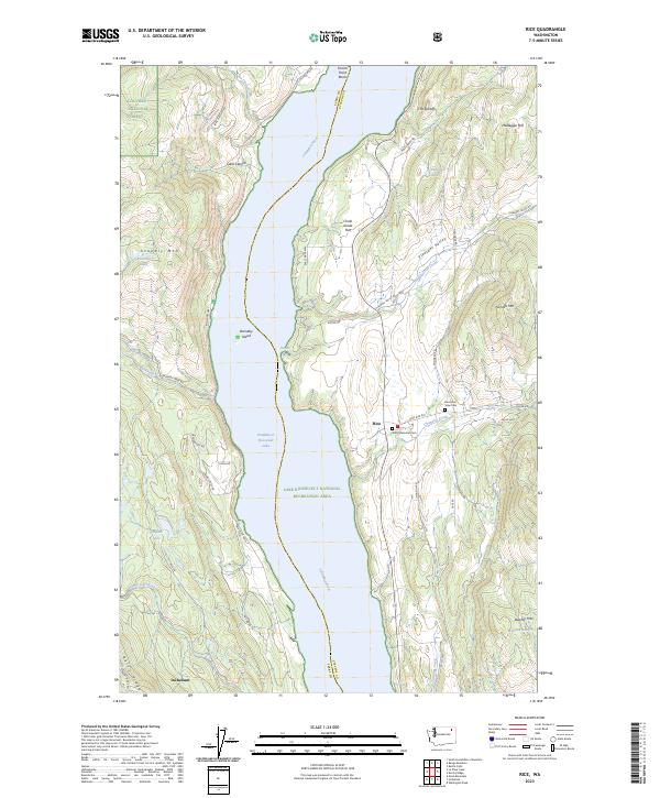
1985 Rice
Stevens County, WA
1985 Turtle Lake
Stevens County, WA
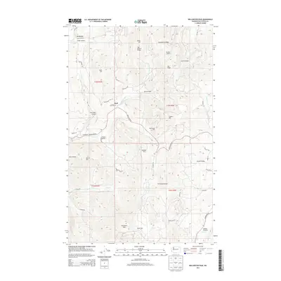
1985 Wellington Peak
Stevens County, WA
1992 Addy Mountain
Stevens County, WA

1992 Aladdin
Stevens County, WA
1992 Belshazzar Mtn
Stevens County, WA
1992 Boundary
Stevens County, WA

1992 Calispell Peak
Stevens County, WA
1992 Churchill Mtn
Stevens County, WA
1992 Cliff Ridge
Stevens County, WA

1992 Deep Lake
Stevens County, WA

1992 Gillette Mtn
Stevens County, WA

1992 Goddards Peak
Stevens County, WA

1992 Lake Gillette
Stevens County, WA
1992 Leadpoint
Stevens County, WA

1992 Nelson Peak
Stevens County, WA
1992 Park Rapids
Stevens County, WA

1992 Rice
Stevens County, WA
1992 Spirit
Stevens County, WA

1992 White Mud Lake
Stevens County, WA
2011 Adams Mountain
Stevens County, WA
2011 Addy Mountain
Stevens County, WA
2011 Aladdin
Stevens County, WA
2011 Arden
Stevens County, WA
2011 Belshazzar Mountain
Stevens County, WA
2011 Benjamin Lake
Stevens County, WA
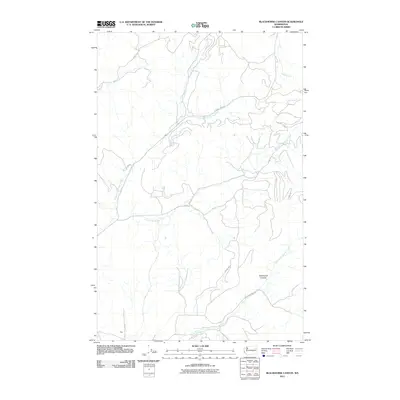
2011 Blackhorse Canyon
Stevens County, WA
2011 Bossburg
Stevens County, WA
2011 Boundary
Stevens County, WA
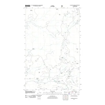
2011 Calispell Peak
Stevens County, WA
2011 Cedonia
Stevens County, WA
2011 China Bend
Stevens County, WA
2011 Churchill Mountain
Stevens County, WA
2011 Cliff Ridge
Stevens County, WA
2011 Deep Lake
Stevens County, WA
2011 Deer Lake
Stevens County, WA
2011 Dunn Mountain
Stevens County, WA
2011 Echo Valley
Stevens County, WA
2011 Empey Mountain
Stevens County, WA
2011 Ford
Stevens County, WA
2011 Forest Center
Stevens County, WA
2011 Fort Spokane
Stevens County, WA
2011 Gillette Mountain
Stevens County, WA
2011 Goddards Peak
Stevens County, WA
2011 Hunters
Stevens County, WA
2011 Kentry Ridge
Stevens County, WA

2011 Lake Gillette
Stevens County, WA
2011 Leadpoint
Stevens County, WA
2011 Long Lake
Stevens County, WA
2011 McCoy Lake
Stevens County, WA

2011 Nelson Peak
Stevens County, WA
2011 Onion Creek
Stevens County, WA
2011 Park Rapids
Stevens County, WA
2011 Rice
Stevens County, WA
2011 Spirit
Stevens County, WA
2011 Stensgar Mountain
Stevens County, WA
2011 Tumtum
Stevens County, WA
2011 Turtle Lake
Stevens County, WA
2011 Waitts Lake
Stevens County, WA
2011 Wellington Peak
Stevens County, WA
2011 Wellpinit
Stevens County, WA
2011 White Mud Lake
Stevens County, WA
2013 Benjamin Lake
Stevens County, WA
2013 Fort Spokane
Stevens County, WA
2014 Adams Mountain
Stevens County, WA
2014 Addy Mountain
Stevens County, WA
2014 Aladdin
Stevens County, WA
2014 Arden
Stevens County, WA
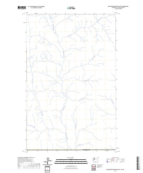
2014 Belshazzar Mountain OE N
Stevens County, WA
2014 Belshazzar Mountain
Stevens County, WA
2014 Blackhorse Canyon
Stevens County, WA
2014 Bossburg
Stevens County, WA
2014 Boundary OE N
Stevens County, WA
2014 Boundary
Stevens County, WA
2014 Calispell Peak
Stevens County, WA
2014 Cedonia
Stevens County, WA
2014 China Bend
Stevens County, WA
2014 Churchill Mountain OE N
Stevens County, WA
2014 Churchill Mountain
Stevens County, WA
2014 Cliff Ridge
Stevens County, WA
2014 Deep Lake
Stevens County, WA
2014 Deer Lake
Stevens County, WA
2014 Dunn Mountain
Stevens County, WA
2014 Echo Valley
Stevens County, WA
2014 Empey Mountain
Stevens County, WA
2014 Ford
Stevens County, WA
2014 Forest Center
Stevens County, WA
2014 Gillette Mountain
Stevens County, WA

2014 Goddards Peak
Stevens County, WA
2014 Hunters
Stevens County, WA
2014 Kentry Ridge
Stevens County, WA
2014 Lake Gillette
Stevens County, WA
2014 Laurier OE N
Stevens County, WA
2014 Leadpoint OE N
Stevens County, WA
2014 Leadpoint
Stevens County, WA
2014 Long Lake
Stevens County, WA
2014 McCoy Lake
Stevens County, WA
2014 Nelson Peak
Stevens County, WA
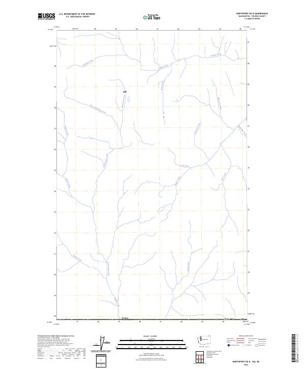
2014 Northport OE N
Stevens County, WA
2014 Onion Creek
Stevens County, WA
2014 Park Rapids
Stevens County, WA
2014 Rice
Stevens County, WA
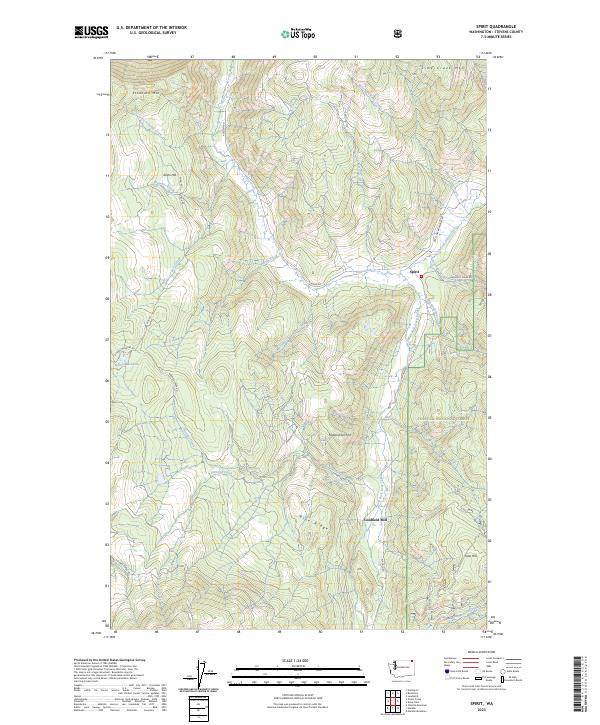
2014 Spirit
Stevens County, WA
2014 Stensgar Mountain
Stevens County, WA
2014 Tumtum
Stevens County, WA

2014 Turtle Lake
Stevens County, WA
2014 Waitts Lake
Stevens County, WA
2014 Wellington Peak
Stevens County, WA
2014 Wellpinit
Stevens County, WA
2014 White Mud Lake
Stevens County, WA
2017 Adams Mountain
Stevens County, WA
2017 Addy Mountain
Stevens County, WA
2017 Aladdin
Stevens County, WA
2017 Arden
Stevens County, WA
2017 Belshazzar Mountain OE N
Stevens County, WA
2017 Belshazzar Mountain
Stevens County, WA
2017 Benjamin Lake
Stevens County, WA
2017 Blackhorse Canyon
Stevens County, WA
2017 Bossburg
Stevens County, WA

2017 Boundary OE N
Stevens County, WA
2017 Boundary
Stevens County, WA
2017 Calispell Peak
Stevens County, WA
2017 Cedonia
Stevens County, WA
2017 China Bend
Stevens County, WA
2017 Churchill Mountain OE N
Stevens County, WA
2017 Churchill Mountain
Stevens County, WA
2017 Cliff Ridge
Stevens County, WA
2017 Deep Lake
Stevens County, WA
2017 Deer Lake
Stevens County, WA
2017 Dunn Mountain
Stevens County, WA
2017 Echo Valley
Stevens County, WA
2017 Empey Mountain
Stevens County, WA
2017 Ford
Stevens County, WA
2017 Forest Center
Stevens County, WA
2017 Fort Spokane
Stevens County, WA
2017 Gillette Mountain
Stevens County, WA
2017 Goddards Peak
Stevens County, WA
2017 Hunters
Stevens County, WA
2017 Kentry Ridge
Stevens County, WA
2017 Lake Gillette
Stevens County, WA
2017 Laurier OE N
Stevens County, WA
2017 Leadpoint OE N
Stevens County, WA
2017 Leadpoint
Stevens County, WA
2017 Long Lake
Stevens County, WA
2017 McCoy Lake
Stevens County, WA
2017 Nelson Peak
Stevens County, WA
2017 Northport OE N
Stevens County, WA
2017 Onion Creek
Stevens County, WA
2017 Park Rapids
Stevens County, WA
2017 Rice
Stevens County, WA
2017 Spirit
Stevens County, WA

2017 Stensgar Mountain
Stevens County, WA
2017 Tumtum
Stevens County, WA
2017 Turtle Lake
Stevens County, WA
2017 Waitts Lake
Stevens County, WA
2017 Wellington Peak
Stevens County, WA
2017 Wellpinit
Stevens County, WA
2017 White Mud Lake
Stevens County, WA
2020 Adams Mountain
Stevens County, WA
2020 Addy Mountain
Stevens County, WA
2020 Aladdin
Stevens County, WA
2020 Arden
Stevens County, WA
2020 Belshazzar Mountain OE N
Stevens County, WA
2020 Belshazzar Mountain
Stevens County, WA
2020 Benjamin Lake
Stevens County, WA
2020 Blackhorse Canyon
Stevens County, WA

2020 Bossburg
Stevens County, WA
2020 Boundary OE N
Stevens County, WA
2020 Boundary
Stevens County, WA
2020 Calispell Peak
Stevens County, WA
2020 Cedonia
Stevens County, WA

2020 China Bend
Stevens County, WA
2020 Churchill Mountain OE N
Stevens County, WA
2020 Churchill Mountain
Stevens County, WA
2020 Cliff Ridge
Stevens County, WA
2020 Deep Lake
Stevens County, WA

2020 Deer Lake
Stevens County, WA
2020 Dunn Mountain
Stevens County, WA
2020 Echo Valley
Stevens County, WA
2020 Empey Mountain
Stevens County, WA
2020 Ford
Stevens County, WA
2020 Forest Center
Stevens County, WA
2020 Fort Spokane
Stevens County, WA
2020 Gillette Mountain
Stevens County, WA
2020 Goddards Peak
Stevens County, WA
2020 Hunters
Stevens County, WA
2020 Kentry Ridge
Stevens County, WA
2020 Lake Gillette
Stevens County, WA
2020 Laurier OE N
Stevens County, WA
2020 Leadpoint OE N
Stevens County, WA
2020 Leadpoint
Stevens County, WA
2020 Long Lake
Stevens County, WA
2020 McCoy Lake
Stevens County, WA
2020 Nelson Peak
Stevens County, WA
2020 Northport OE N
Stevens County, WA
2020 Onion Creek
Stevens County, WA
2020 Park Rapids
Stevens County, WA
2020 Rice
Stevens County, WA
2020 Spirit
Stevens County, WA
2020 Stensgar Mountain
Stevens County, WA
2020 Tumtum
Stevens County, WA

2020 Turtle Lake
Stevens County, WA
2020 Waitts Lake
Stevens County, WA
2020 Wellington Peak
Stevens County, WA
2020 Wellpinit
Stevens County, WA
2020 White Mud Lake
Stevens County, WA

2023 Adams Mountain
Stevens County, WA
2023 Addy Mountain
Stevens County, WA
2023 Aladdin
Stevens County, WA
2023 Arden
Stevens County, WA
2023 Belshazzar Mountain OE N
Stevens County, WA
2023 Belshazzar Mountain
Stevens County, WA
2023 Benjamin Lake
Stevens County, WA
2023 Blackhorse Canyon
Stevens County, WA
2023 Bossburg
Stevens County, WA
2023 Boundary OE N
Stevens County, WA
2023 Boundary
Stevens County, WA
2023 Calispell Peak
Stevens County, WA
2023 Cedonia
Stevens County, WA
2023 China Bend
Stevens County, WA
2023 Churchill Mountain OE N
Stevens County, WA
2023 Churchill Mountain
Stevens County, WA
2023 Cliff Ridge
Stevens County, WA
2023 Deep Lake
Stevens County, WA
2023 Deer Lake
Stevens County, WA
2023 Dunn Mountain
Stevens County, WA
2023 Echo Valley
Stevens County, WA
2023 Empey Mountain
Stevens County, WA
2023 Ford
Stevens County, WA
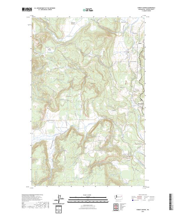
2023 Forest Center
Stevens County, WA

2023 Fort Spokane
Stevens County, WA
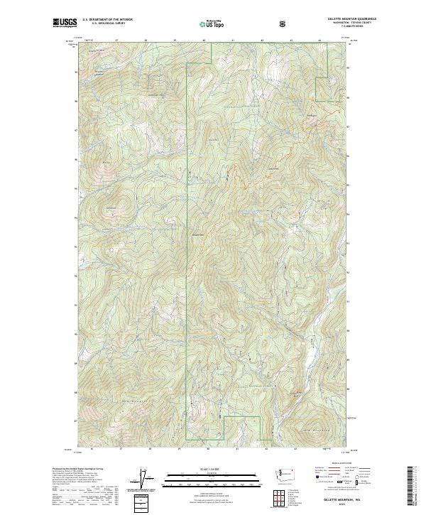
2023 Gillette Mountain
Stevens County, WA
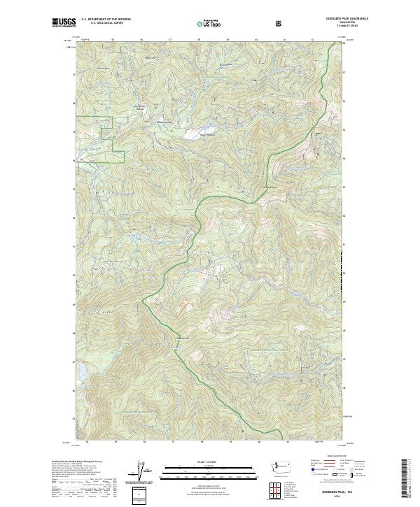
2023 Goddards Peak
Stevens County, WA
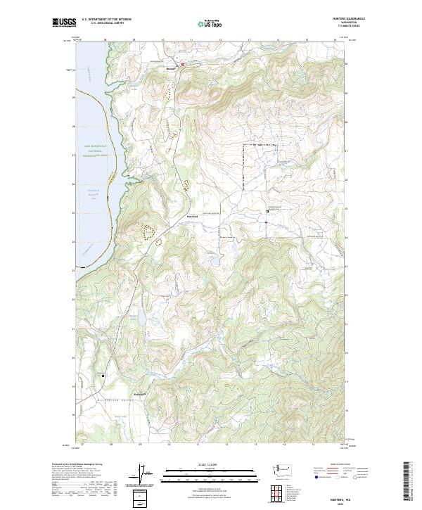
2023 Hunters
Stevens County, WA
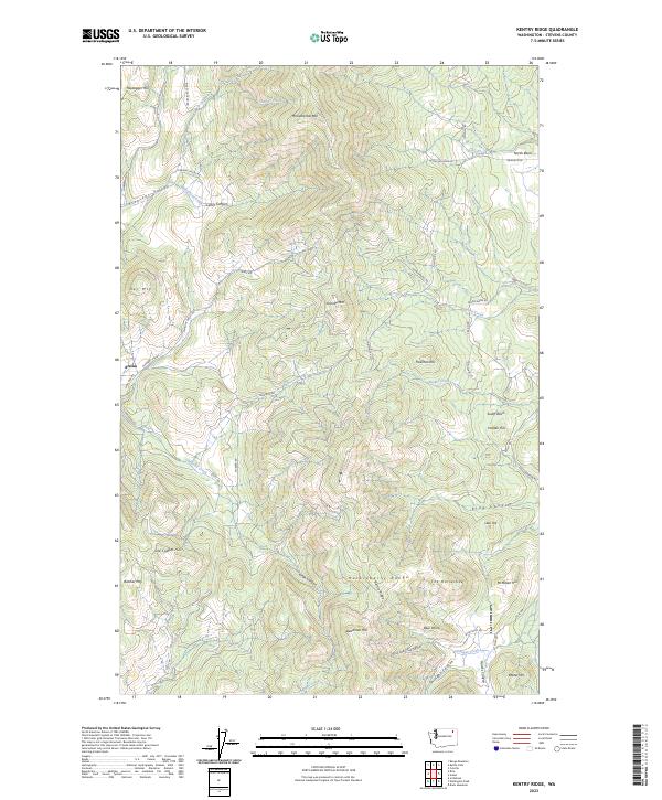
2023 Kentry Ridge
Stevens County, WA
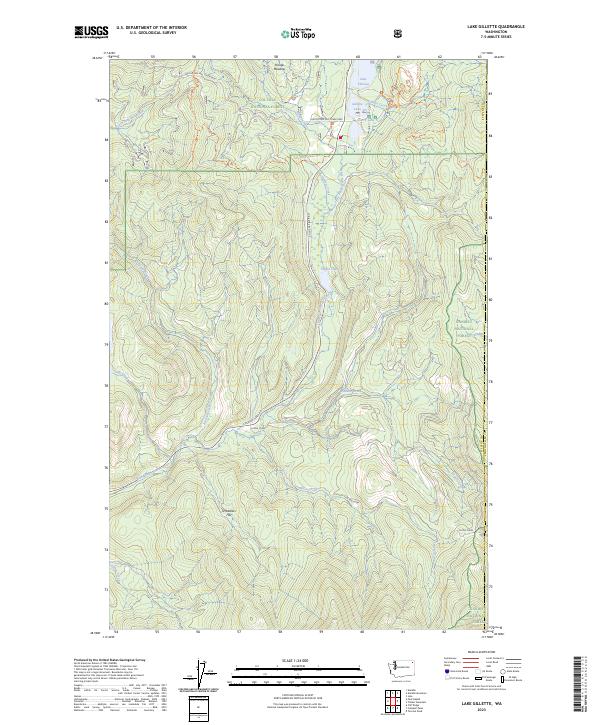
2023 Lake Gillette
Stevens County, WA
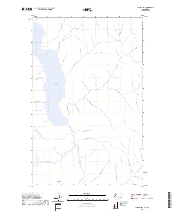
2023 Laurier OE N
Stevens County, WA
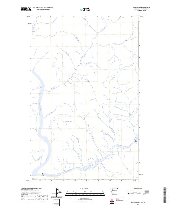
2023 Leadpoint OE N
Stevens County, WA
2023 Leadpoint
Stevens County, WA
2023 Long Lake
Stevens County, WA
2023 McCoy Lake
Stevens County, WA
2023 Nelson Peak
Stevens County, WA
2023 Northport OE N
Stevens County, WA
2023 Onion Creek
Stevens County, WA
2023 Park Rapids
Stevens County, WA
2023 Rice
Stevens County, WA
2023 Spirit
Stevens County, WA
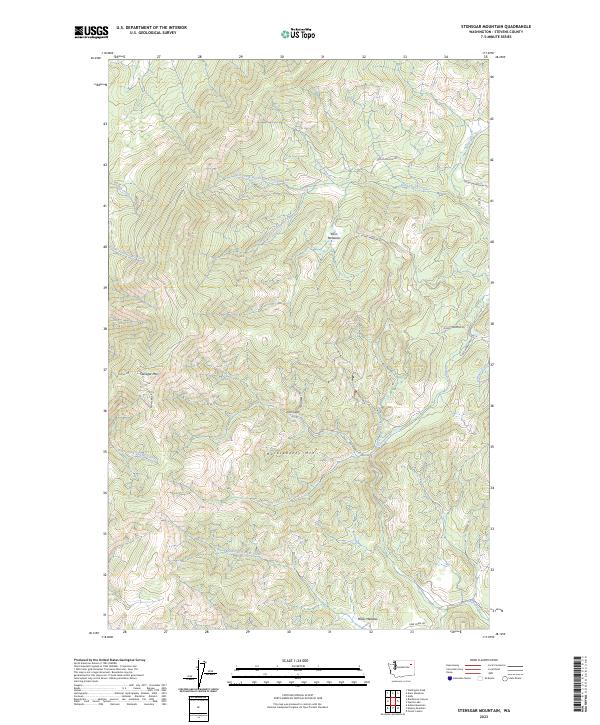
2023 Stensgar Mountain
Stevens County, WA
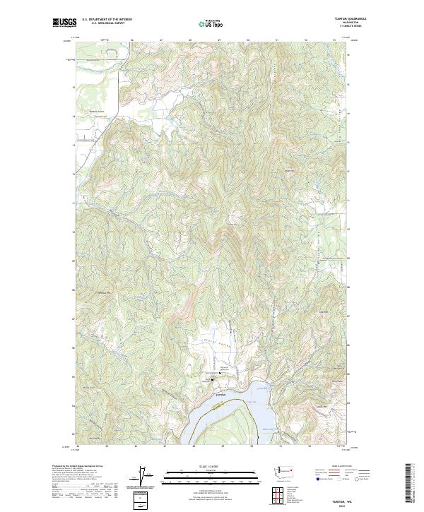
2023 Tumtum
Stevens County, WA
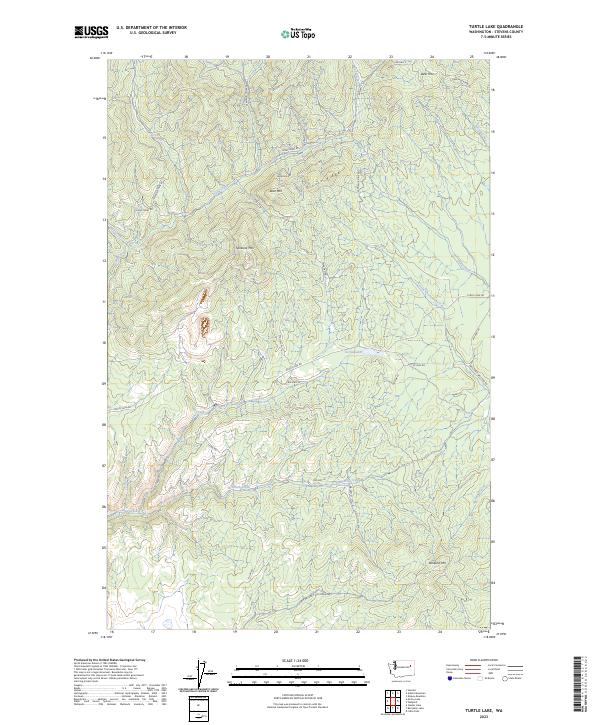
2023 Turtle Lake
Stevens County, WA
2023 Waitts Lake
Stevens County, WA
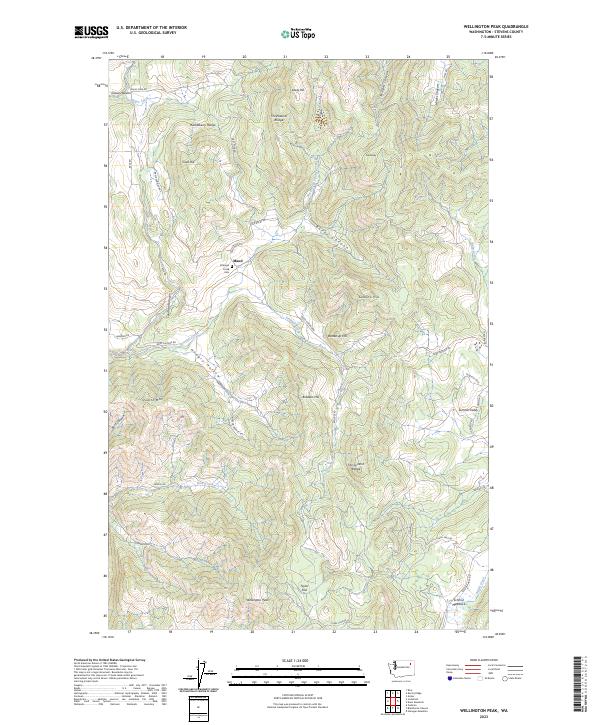
2023 Wellington Peak
Stevens County, WA
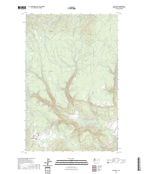
2023 Wellpinit
Stevens County, WA
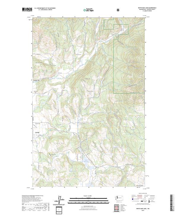
2023 White Mud Lake
Stevens County, WA