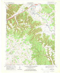
1967 Map of Nelsonville
USGS Topo · Published 1969About this map
Rolling Fork carves a deep meandering path across this landscape, dividing the ridges and hollows where Hardin, LaRue, and Nelson Counties meet. The mid-century topography reveals a mix of old agrarian roots and modern infrastructure, notably where the Blue Grass Parkway and Younger Toll Road cut across the northern hills. Longstanding family footprints are evident in the numerous small burial grounds such as Bledsoe Cem, Johnson Cem, and Neff Cem that dot the high ground between Broadhead Hollow and Farmers Ridge.
Find a feature on this map
49 named features on this map. Tap any name to fly to it.
Don’t see what you’re looking for? This feature index may not catch every label — zoom into the map to look around manually.
Map Details
Editions of this 1967 Nelsonville Map
3 editions found
Other maps of this area

1935 · Elizabethtown
USGS Topo · 1:48,000

1936 · Vine Grove
USGS Topo · 1:62,500

1938 · Elizabethtown
USGS Topo · 1:62,500

1943 · Vine Grove
USGS Topo · 1:62,500

1946 · Colesburg
USGS Topo · 1:24,000

1946 · Vine Grove
USGS Topo · 1:62,500

1949 · Cravens
USGS Topo · 1:24,000

1949 · Tonieville
USGS Topo · 1:24,000

1949 · Elizabethtown
USGS Topo · 1:24,000

1949 · Shepherdsville
USGS Topo · 1:62,500