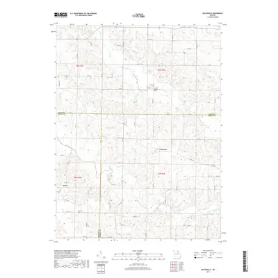
2017 Map of Nelsonville
USGS Topo · Published 2017About this map
Nelsonville and the nearby settlement of Sigsbee anchor this landscape at the intersection of Marion, Shelby, and Lewis Counties. The terrain is defined by a dense network of waterways, most notably the meandering South Fabius River and Troublesome Creek. The area’s agrarian character is evident in the numerous private water bodies named for local figures, such as Doctor Wells Lake, Doscher Brothers Lake, and Tallent Lake.
Find a feature on this map
69 named features on this map. Tap any name to fly to it.
Don’t see what you’re looking for? This feature index may not catch every label — zoom into the map to look around manually.
Map Details
Editions of this 2017 Nelsonville Map
This is the sole edition of this map. No revisions or reprints were ever made.
Other maps of this area

1903 · Kahoka
USGS Topo · 1:125,000

1903 · Palmyra
USGS Topo · 1:125,000

1948 · Quincy
USGS Topo · 1:250,000

1949 · Durham
USGS Topo · 1:24,000

1949 · Philadelphia
USGS Topo · 1:24,000

1950 · Durham
USGS Topo · 1:24,000

1950 · Philadelphia
USGS Topo · 1:24,000

1950 · Lewistown
USGS Topo · 1:24,000
1950 · Monticello
USGS Topo · 1:24,000

1950 · La Belle
USGS Topo · 1:24,000