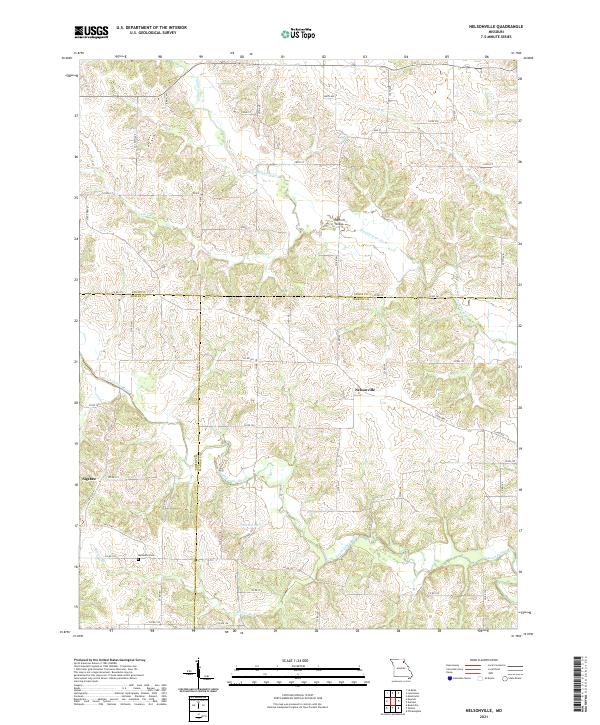
2021 Map of Nelsonville
USGS Topo · Published 2021About this map
Nelsonville and the surrounding farmland of Marion, Lewis, and Shelby Counties are defined by a complex network of waterways feeding the South Fabius River. This modern survey reveals a landscape where rural life is organized around these drainage patterns, with smaller tributaries like Troublesome Cr, Long Br, and Brower Br carving through the agricultural terrain. The map provides clear evidence of the area's early social foundations, notably at the Methodist Cem near Sigsbee and the Haycraft Bridge crossing. While the primary road network is established by State Hwy D and State Hwy J, a dense grid of numbered county roads and avenues shows the continued division of land into small-scale farming plots, punctuated by features like Tallent Lake.
Find a feature on this map
63 named features on this map. Tap any name to fly to it.
Don’t see what you’re looking for? This feature index may not catch every label — zoom into the map to look around manually.
Map Details
Editions of this 2021 Nelsonville Map
This is the sole edition of this map. No revisions or reprints were ever made.
Other maps of this area

1903 · Kahoka
USGS Topo · 1:125,000

1903 · Palmyra
USGS Topo · 1:125,000

1948 · Quincy
USGS Topo · 1:250,000

1949 · Durham
USGS Topo · 1:24,000

1949 · Philadelphia
USGS Topo · 1:24,000

1950 · Durham
USGS Topo · 1:24,000

1950 · Philadelphia
USGS Topo · 1:24,000

1950 · Lewistown
USGS Topo · 1:24,000
1950 · Monticello
USGS Topo · 1:24,000

1950 · La Belle
USGS Topo · 1:24,000