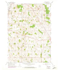
1959 Map of Nenno
USGS Topo · Published 1972About this map
Dairy country and small farming hamlets define this 1959 survey of the Dodge and Washington County line. The landscape is dotted with rural education centers such as Christ's Manger Sch, Herman Sch, and Trinity Sch, reflecting a time when neighborhood schoolhouses were the backbone of Wisconsin's agricultural communities. Small intersections serve as local hubs, including Hochheim and Nenno, which anchor the surrounding townships of Herman and Addison.
Find a feature on this map
27 named features on this map. Tap any name to fly to it.
Don’t see what you’re looking for? This feature index may not catch every label — zoom into the map to look around manually.
Map Details
Editions of this 1959 Nenno Map
3 editions found
Other maps of this area

1904 · Hartford
USGS Topo · 1:62,500

1955 · Waupun
USGS Topo · 1:62,500

1955 · Campbellsport
USGS Topo · 1:62,500

1955 · Horicon
USGS Topo · 1:62,500

1957 · Madison
USGS Topo · 1:250,000

1959 · Hartford
USGS Topo · 1:62,500

1959 · Nenno
USGS Topo · 1:24,000

1959 · Allenton
USGS Topo · 1:24,000
1959 · Hartford East
USGS Topo · 1:24,000
1959 · Hartford West
USGS Topo · 1:24,000