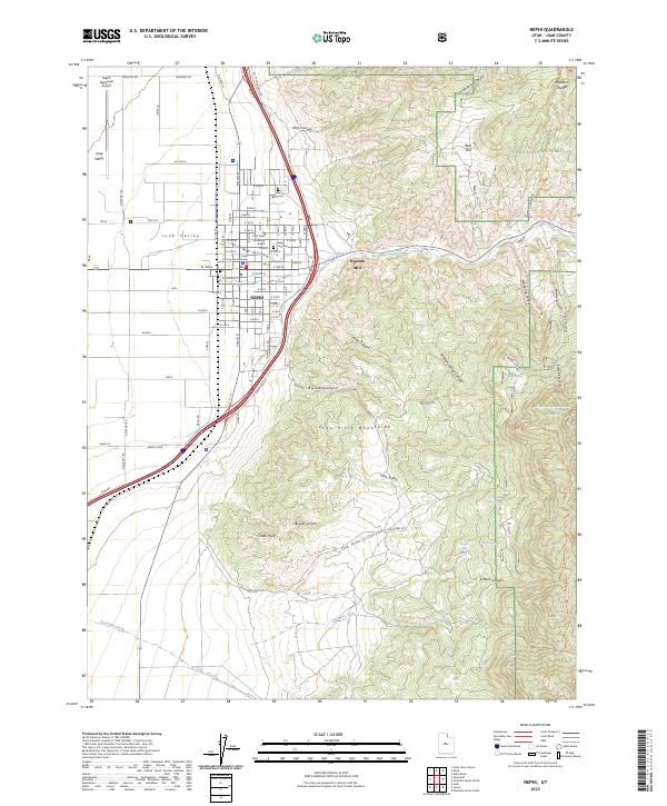
2023 Map of Nephi
USGS Topo · Published 2023About this map
Nephi serves as the focal point of this Juab Valley survey, situated where the Wasatch Range meets the San Pitch Mountains. The town's civic heart is anchored by the Juab County Court House and a local branch of Utah State University - Nephi, while its burial grounds, Vine Bluff Cem and Nephi City Cem, provide significant touchstones for genealogical research. The landscape transition from the valley floor to the high peaks is marked by numerous drainage systems, including Salt Creek and the southern reaches of the Mount Nebo Wilderness. Industrial activity is noted at the Gypsum Mill east of the city, while the aviation corridor is defined by the Nephi Municipal Airport to the northwest. This modern data reflects the enduring importance of water and passage through the mountain gaps, shown through features like Old Pinery Canyon and Miller Canyon.
Find a feature on this map
68 named features on this map. Tap any name to fly to it.
Don’t see what you’re looking for? This feature index may not catch every label — zoom into the map to look around manually.
Map Details
Editions of this 2023 Nephi Map
This is the sole edition of this map. No revisions or reprints were ever made.
Other maps of this area

1885 · Manti
USGS Topo · 1:250,000

1895 · Manti
USGS Topo · 1:250,000

1951 · Moroni
USGS Topo · 1:62,500

1951 · Santaquin
USGS Topo · 1:62,500

1951 · Nephi
USGS Topo · 1:62,500

1952 · Santaquin Peak
USGS Topo · 1:62,500

1956 · Price
USGS Topo · 1:250,000

1960 · Price
USGS Topo · 1:250,000

1962 · Price
USGS Topo · 1:250,000
1979 · Slate Jack Canyon
USGS Topo · 1:24,000