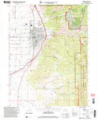
2001 Map of Nephi
USGS Topo · Published 2004About this map
Nephi serves as the focal point of this regional study, situated at the base of the San Pitch Mountains where Salt Creek Canyon opens into the Juab Valley. The town layout is clearly defined, including civic landmarks like City Hall, the Po, and a local Cem, alongside recreational spaces like the Athletic Fields and Golf Course. The transition from the urban grid to the wilderness is immediate, with the Mount Nebo Wilderness and Uinta National Forest dominating the high ground to the northeast.
Find a feature on this map
50 named features on this map. Tap any name to fly to it.
Don’t see what you’re looking for? This feature index may not catch every label — zoom into the map to look around manually.
Map Details
Editions of this 2001 Nephi Map
This is the sole edition of this map. No revisions or reprints were ever made.
Other maps of this area

1885 · Manti
USGS Topo · 1:250,000

1895 · Manti
USGS Topo · 1:250,000

1951 · Moroni
USGS Topo · 1:62,500

1951 · Santaquin
USGS Topo · 1:62,500

1951 · Nephi
USGS Topo · 1:62,500

1952 · Santaquin Peak
USGS Topo · 1:62,500

1956 · Price
USGS Topo · 1:250,000

1960 · Price
USGS Topo · 1:250,000

1962 · Price
USGS Topo · 1:250,000
1979 · Slate Jack Canyon
USGS Topo · 1:24,000